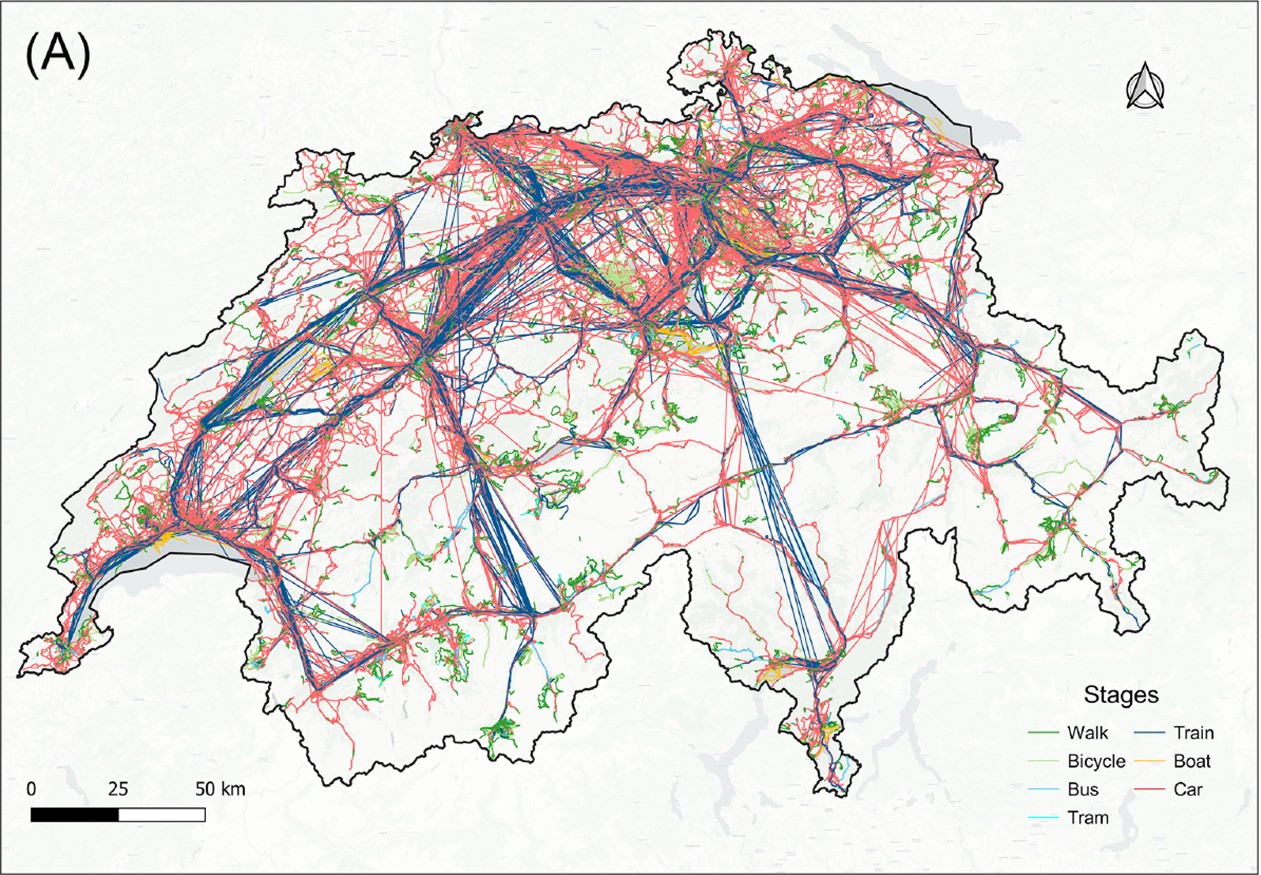
Evaluating geospatial context information for travel mode detection
Title: Evaluating geospatial context information for travel mode detection


Title: Evaluating geospatial context information for travel mode detection
Title: Extracting the pickpocketing information implied in the built environment by treating it as the anomaliesAbstractThe practice of crime risk map
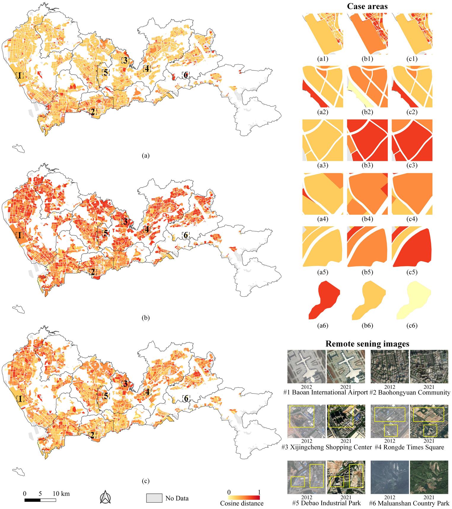
Unsupervised land-use change detection using multi-temporal POI embedding
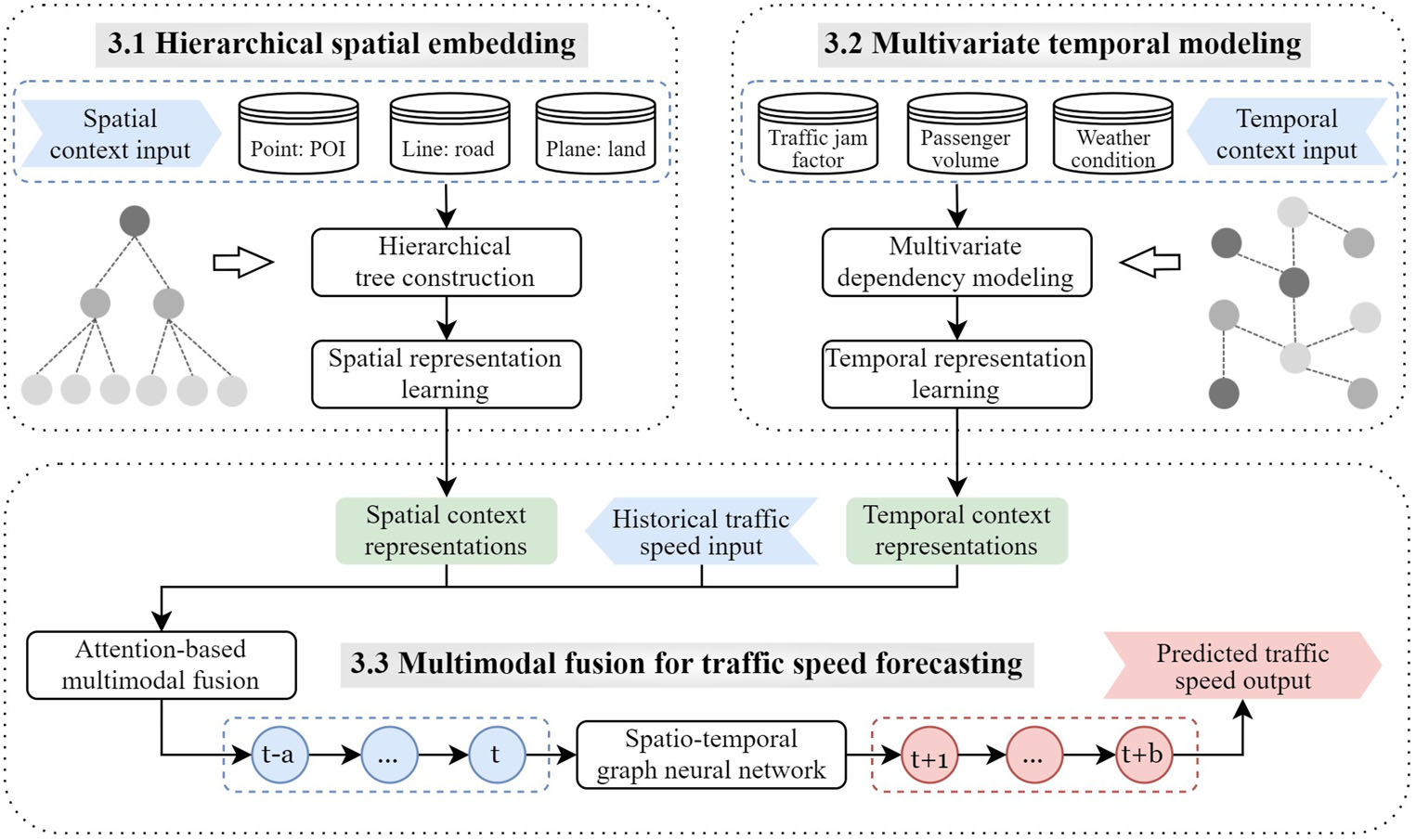
Title: Incorporating multimodal context information into traffic speed forecasting through graph deep learning
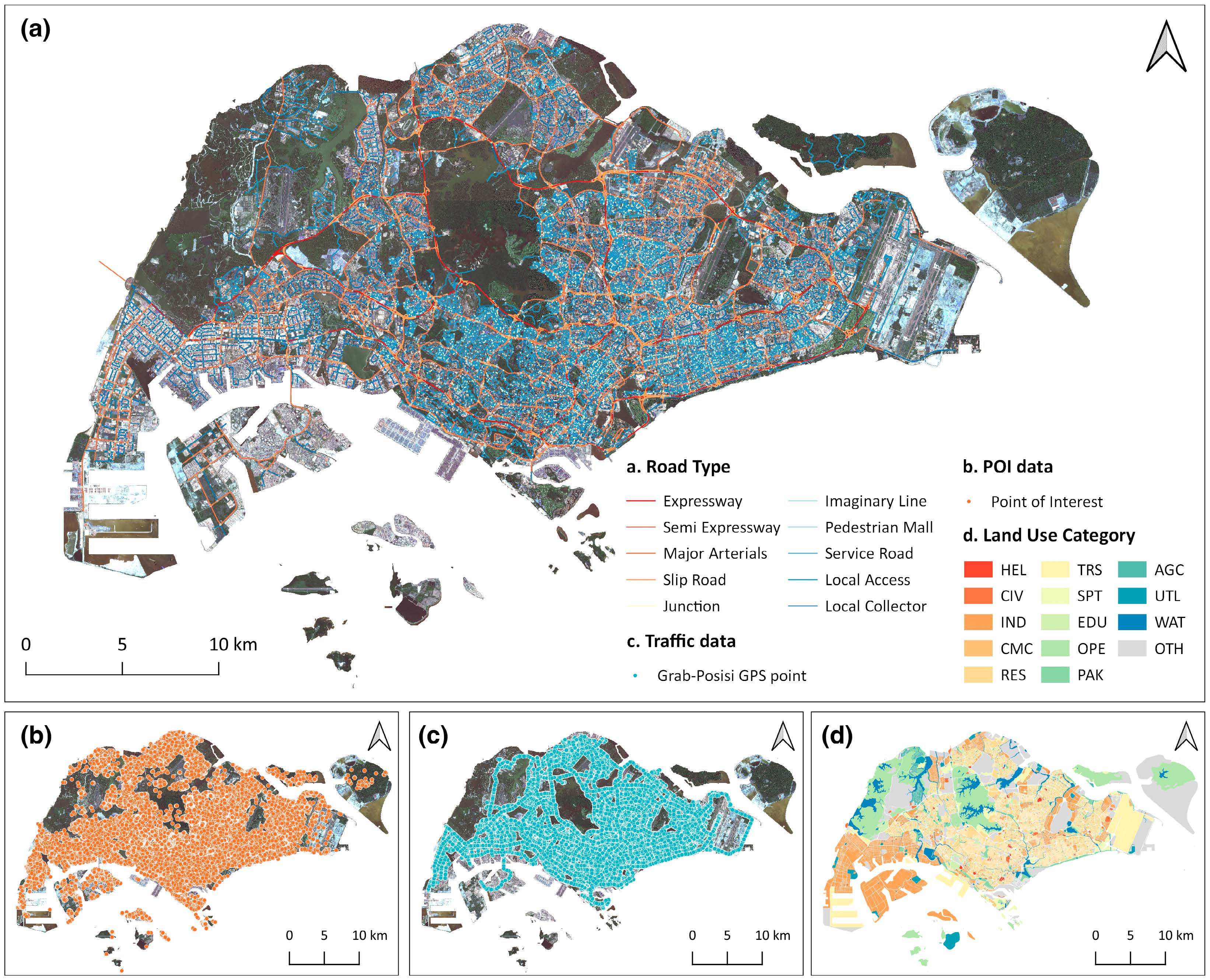
Title: Street-level traffic flow and context sensing analysis through semantic integration of multisource geospatial data
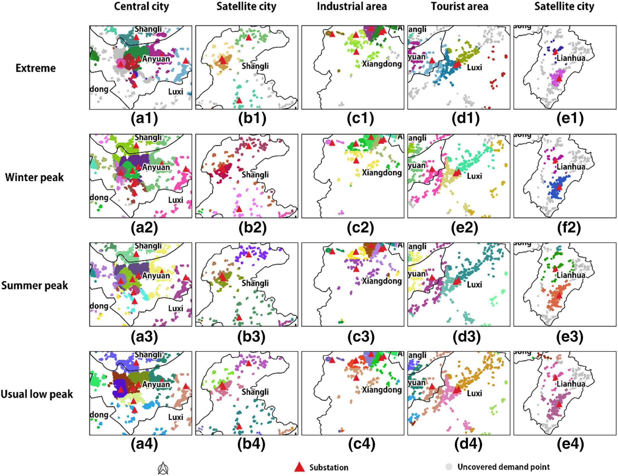
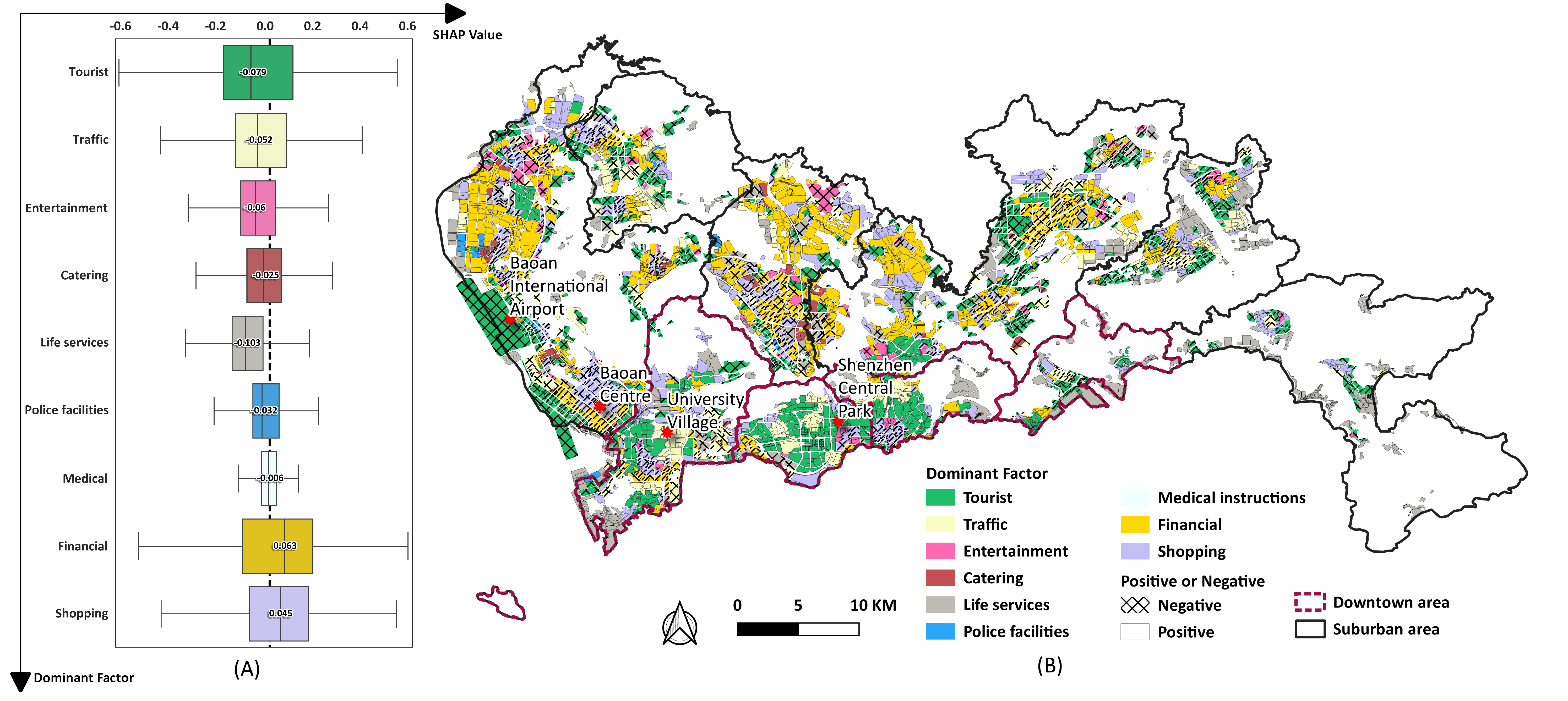
A site selection framework for urban power substation at micro-scale using spatial optimization strategy and geospatial big data
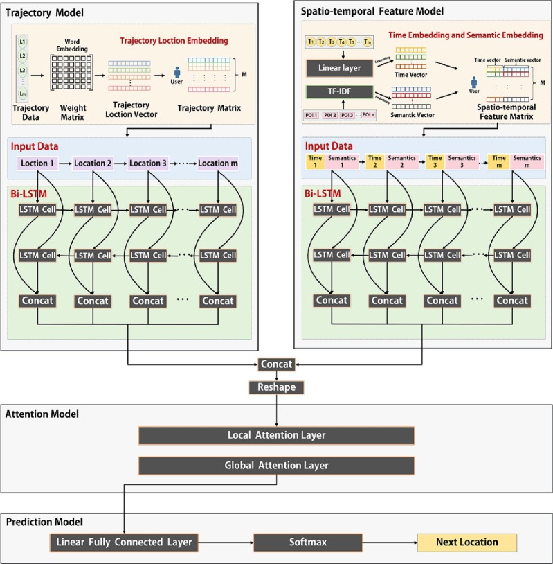
Title: Predicting mobile users' next location using the semantically enriched geo-embedding model and the multilayer attention mechanism
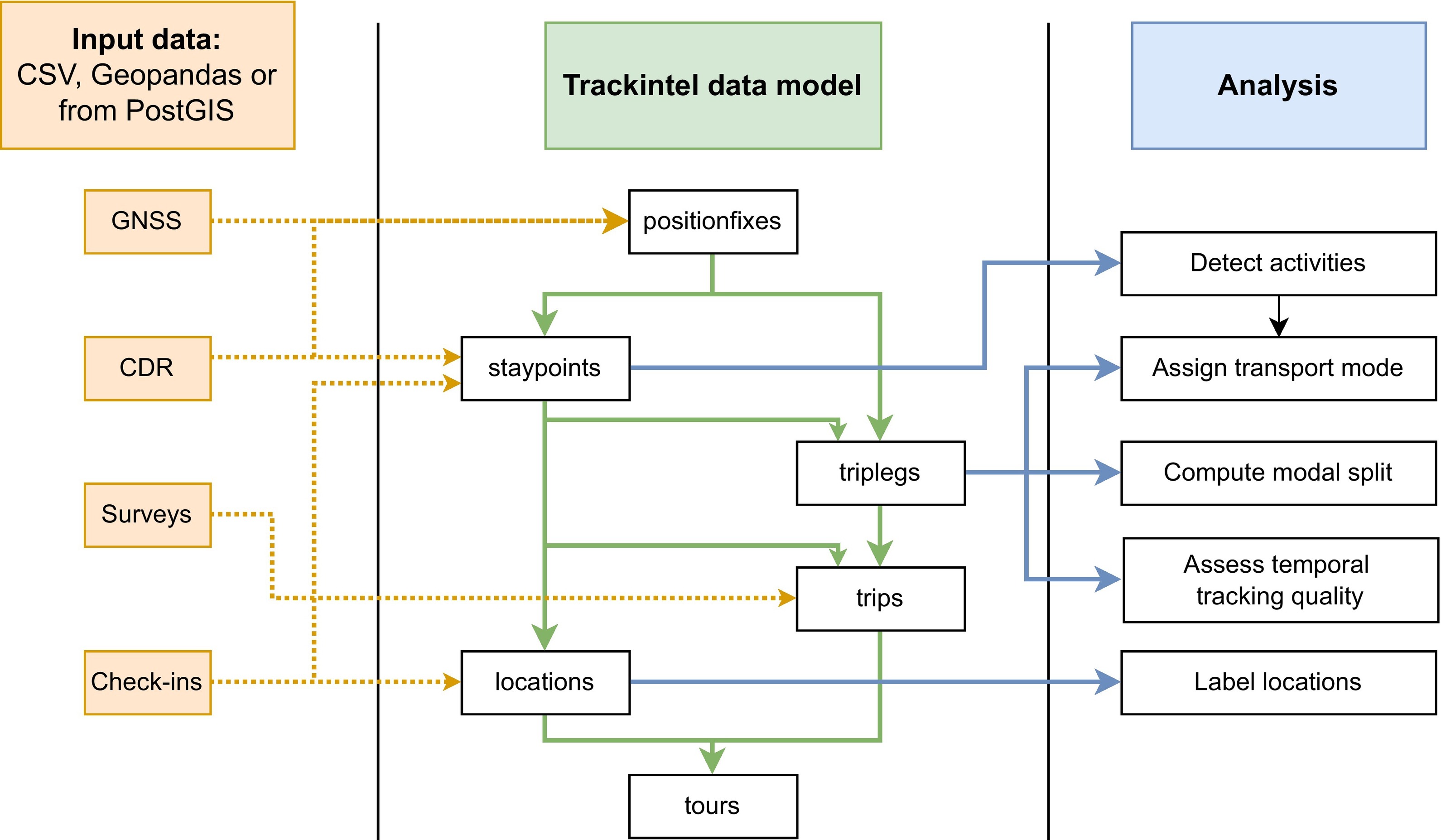
Trackintel: An open-source Python library for human mobility analysis
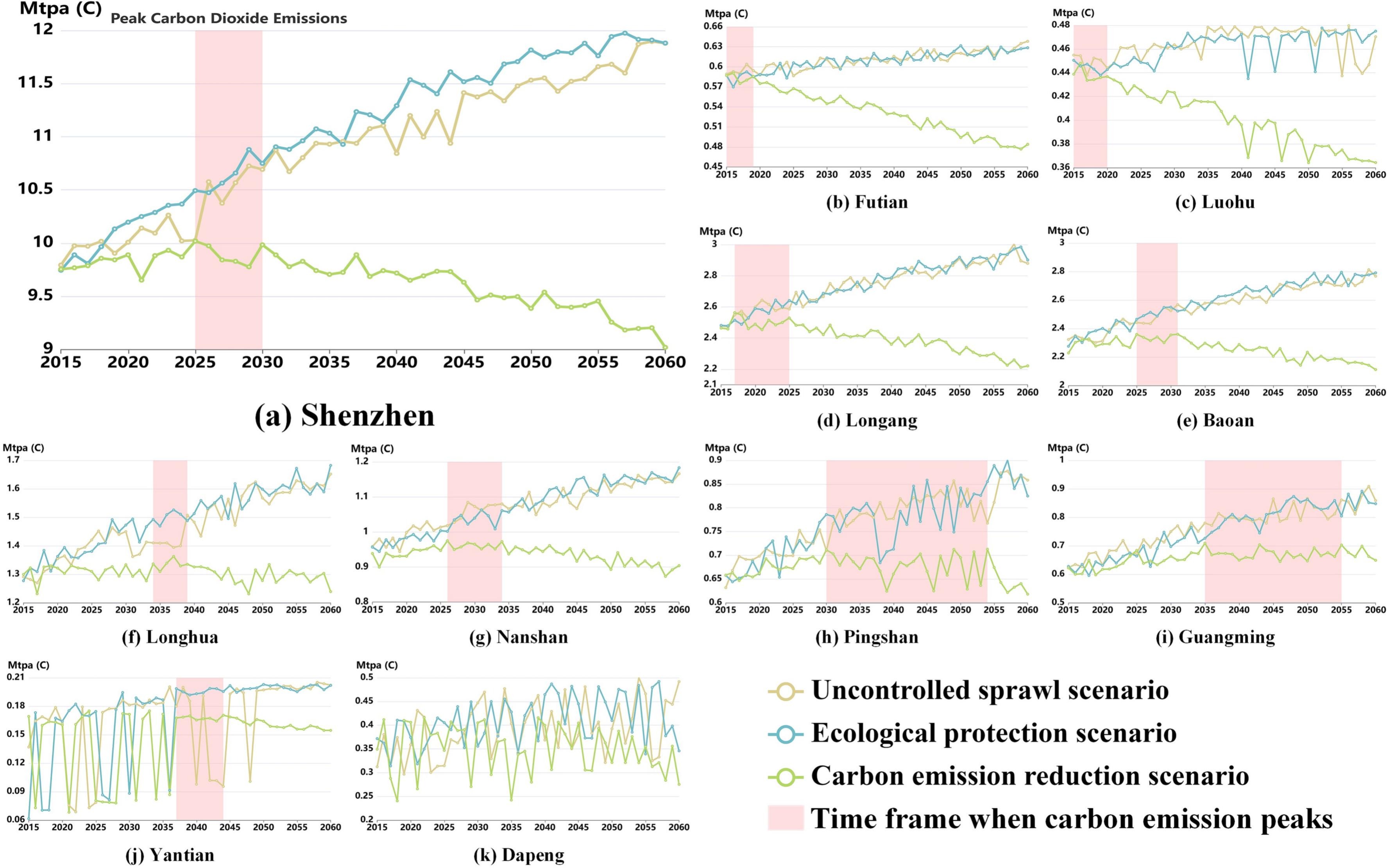
Title: CarbonVCA: A cadastral parcel-scale carbon emission forecasting framework for peak carbon emissions
Title: Gauging urban resilience in the United States during the COVID-19 pandemic via social network analysis
UrbanComp
![]()
![]()
![]()