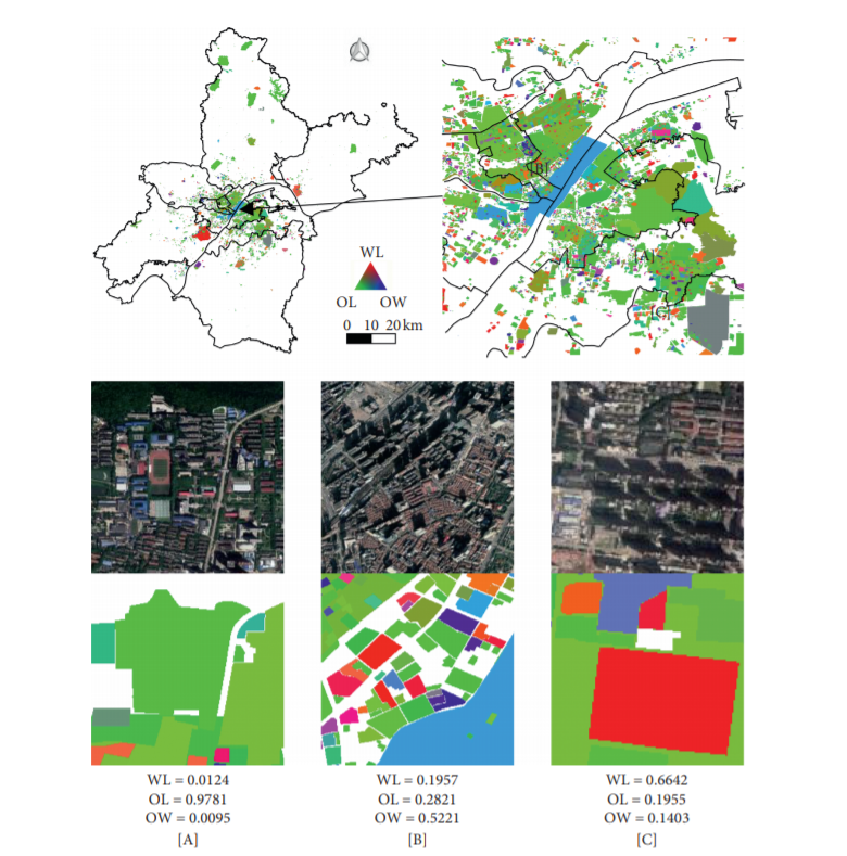
Delineating Mixed Urban “Jobs-Housing” Patterns by Using HSR Remote-Sensing Imagery
Abstract+e spatial distribution pattern of jobs and housing plays a vital role in urban planning and traffic construction. However, obtaining the jobs


Abstract+e spatial distribution pattern of jobs and housing plays a vital role in urban planning and traffic construction. However, obtaining the jobs
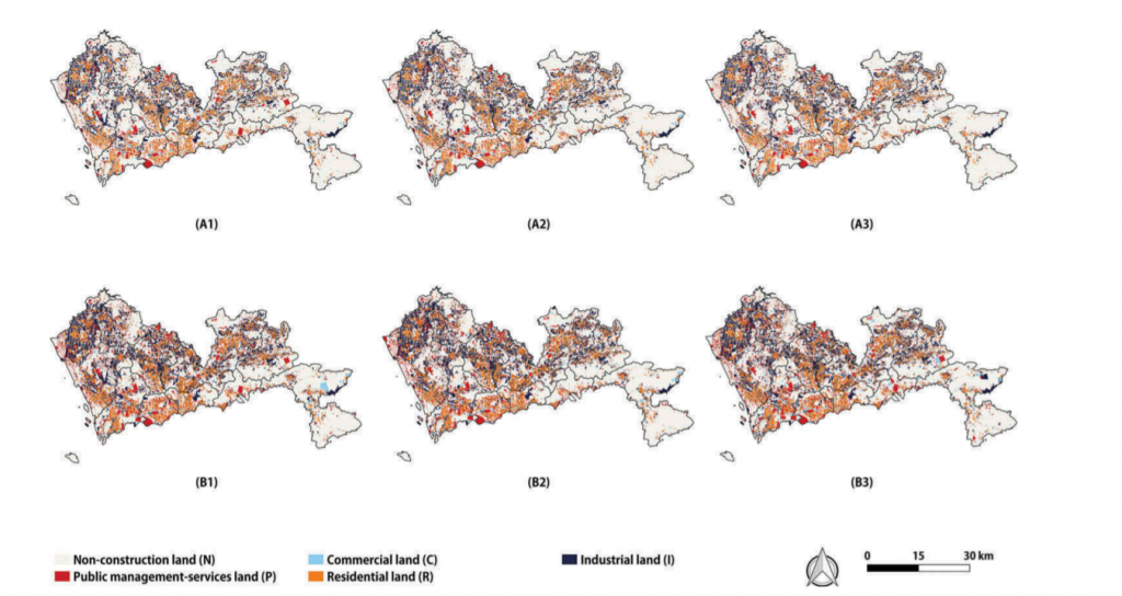
The formulation of mixed urban land uses is not only intended to find the ideal scenario of land use but also regarded as a way toward sust
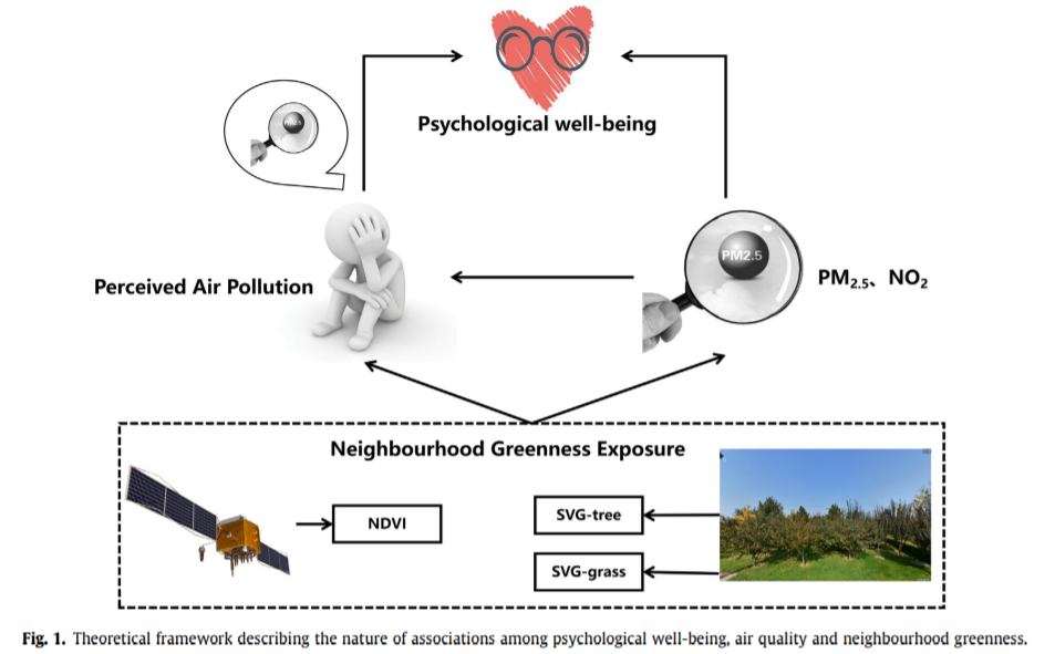
[Residential-greenness-air-pollution-and-psychological-well-being-among-urban-residents-in-Guangzhou-China](http://www.urbancomp.net/wp-
AbstractThe development of geospatial big data makes it possible to study traffic-congestion issues. In particular, floating car data (FCD) is very su
ABSTRACTVector-based cellular automata (VCA) models have been applied in land use change simulations at fine scales. However, the neighborhood effects
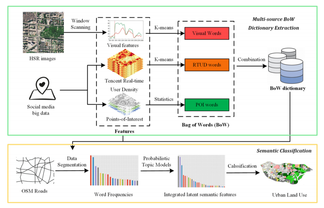
AbstractThe rapid development of information technology and location techniques not only leads to an increasing growth of massive geospatial big data
ABSTRATAccording to an urban planning directive issued by the Chinese Central Government in early 2016, the Community Opening Policy will be put on th
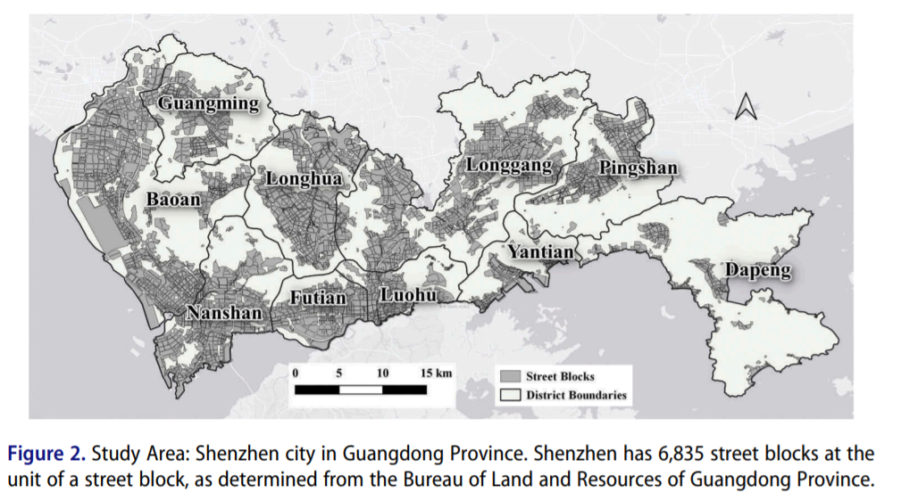
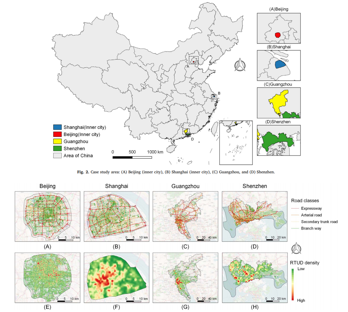
ABSTRATWith the rapid progress of China’s urbanization, research on the automatic detection of land-use patterns in Chinese cities is of substantial i
ABSTRATThe development of geospatial big data makes it possible to study traffic congestion issues through floating car data (FCD). FCD can help predi
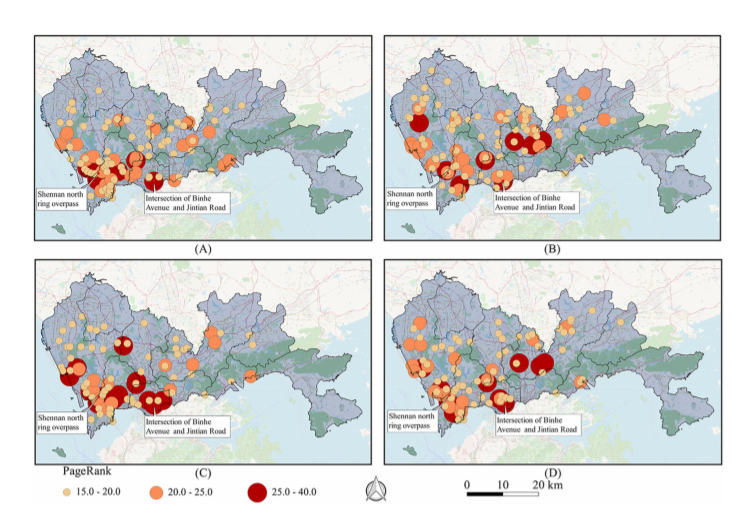
AbstractThe spatial distribution characteristics and activity patterns of urban populations play essential roles in studies of spatial isolation, opti
UrbanComp
![]()
![]()
![]()