_1628074565997.png)
人口集聚对中国城市经济增长的影响分析
摘要人口集聚是新经济地理学关注的焦点,由于连续年份城市建设用地数据难以获取等原因,目前仍无法明确人口集聚是否促进了中国城市经济增长。采用消除连续年份时空异质性的DMSP/OLS夜间灯光数据方法所提取的建设用地等数据,通过构建人口密度影响地均收入水平的理论模型,分析2005-2013年间人口集聚对中国


摘要人口集聚是新经济地理学关注的焦点,由于连续年份城市建设用地数据难以获取等原因,目前仍无法明确人口集聚是否促进了中国城市经济增长。采用消除连续年份时空异质性的DMSP/OLS夜间灯光数据方法所提取的建设用地等数据,通过构建人口密度影响地均收入水平的理论模型,分析2005-2013年间人口集聚对中国
AbstractHigh spatial resolution (HSR) imagery scene classification has been the subject of increased interest in recent years, and has great potential
AbstractUrban extent data play an important role in urban management and urban studies, such as monitoring the process of urbanization and changes in
AbstractUrban growth boundaries (UGBs) have been commonly regarded as a useful tool for controlling urban sprawl. There is a need to create models tha
_1628067832291.png)
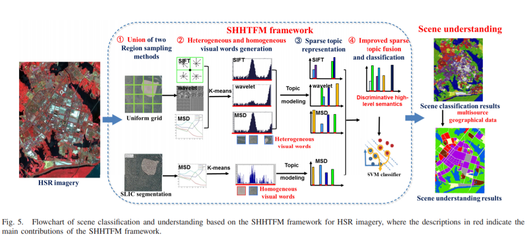
AbstractHigh spatial resolution (HSR) imagery scene classification has recently attracted increased attention. The bag-of-visual-words (BoVW) model is
AbstractAccording to an urban planning directive issued by the Chinese Central Government in early 2016, the Community Opening Policy will be put on t
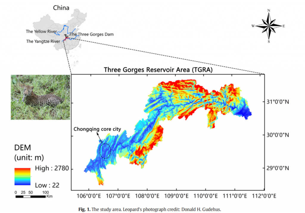
AbstractUnderstanding the impact of urban expansion on functional connectivity is significant to biodiversity conservation. Particularly, in the Three
_1628066373433.png)
AbstractThe accurate mapping of urban housing prices at a fine scale is essential to policymaking and urban studies, such as adjusting economic factor
AbstractArising from rapid growth of economy and population,urban sprawl has become a major challenge for sustainable urban development in the world.
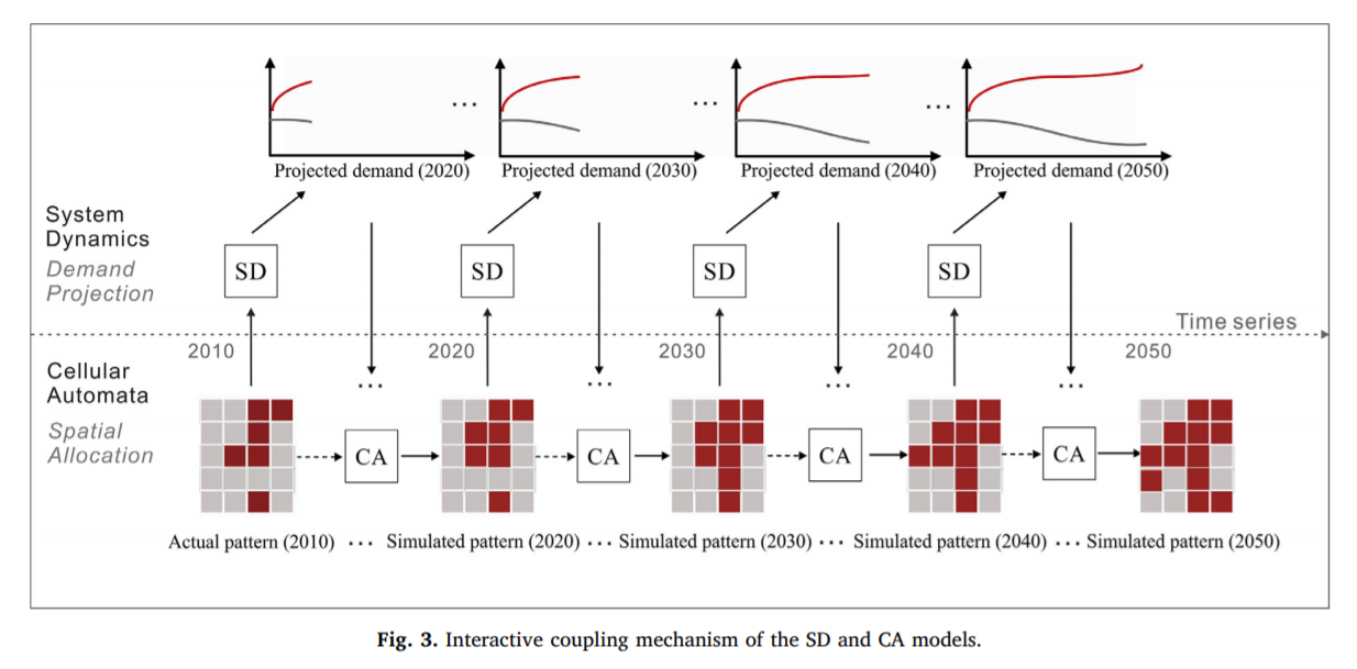
AbstractLand use and land cover change (LUCC) simulation models are effective and reproducible tools for analyzing both the causes and consequences of
UrbanComp
![]()
![]()
![]()