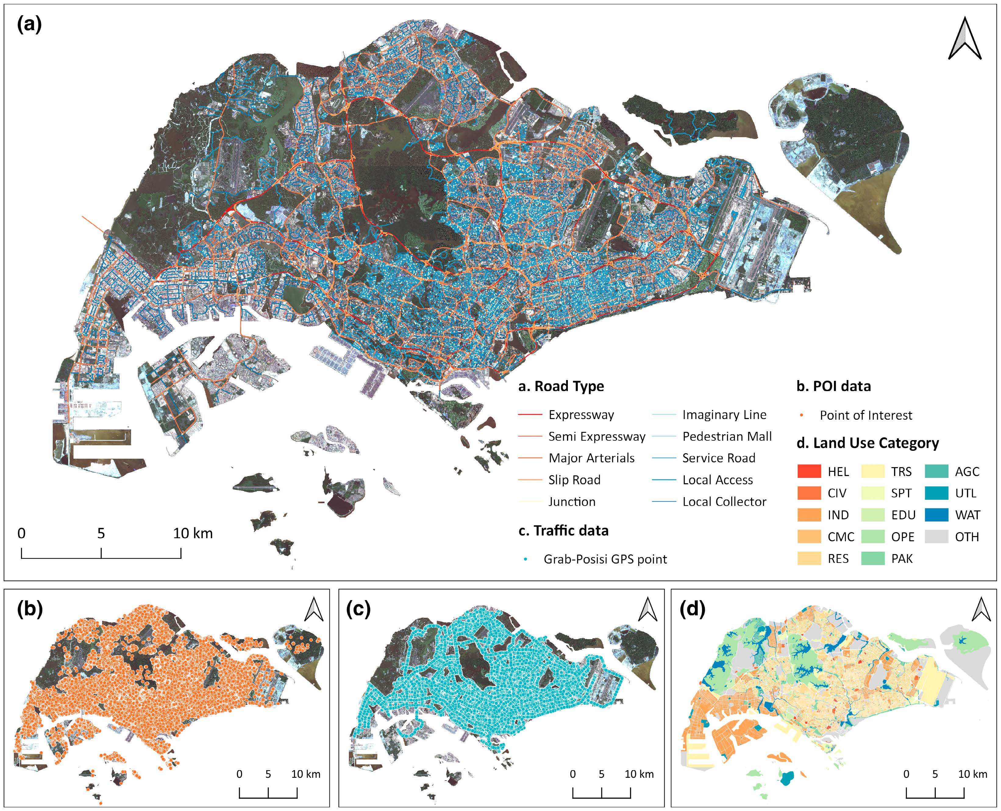
Street-level traffic flow and context sensing analysis through semantic integration
Title: Street-level traffic flow and context sensing analysis through semantic integration of multisource geospatial data


Title: Street-level traffic flow and context sensing analysis through semantic integration of multisource geospatial data
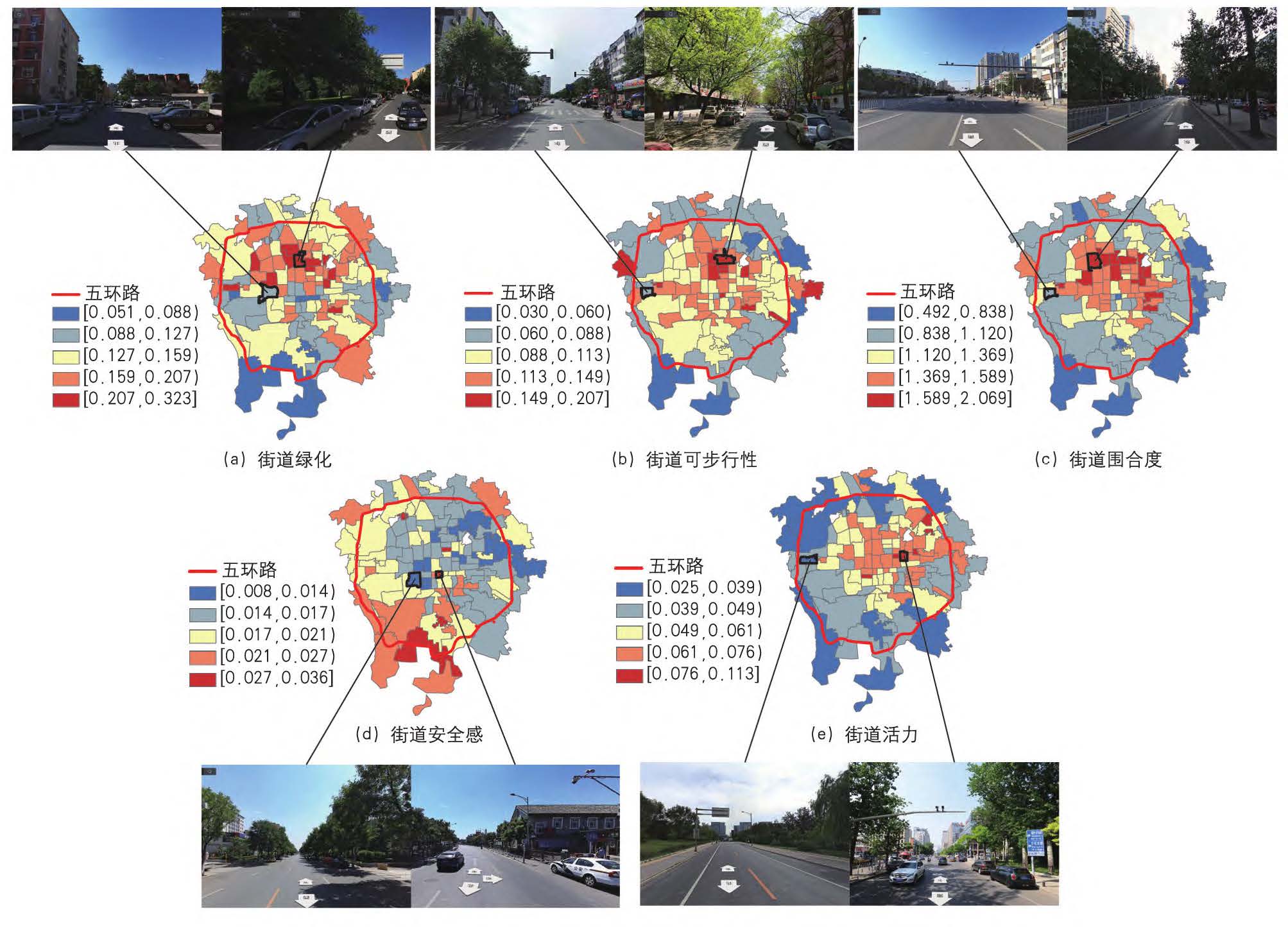
人本尺度街道空间品质对学童步行通学的影响——以北京市为例 Impact of Human-scale Street Space Quality on Walking to School by School-age Children:A Case Study of Beijing
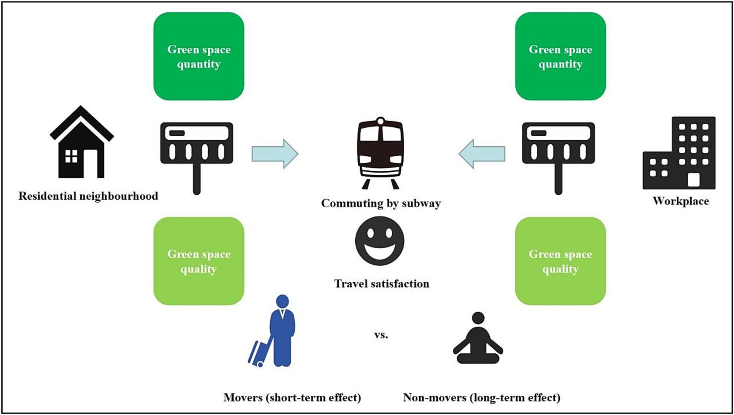
Title: Green space exposure at subway stations, transportation mode choice and travel satisfaction
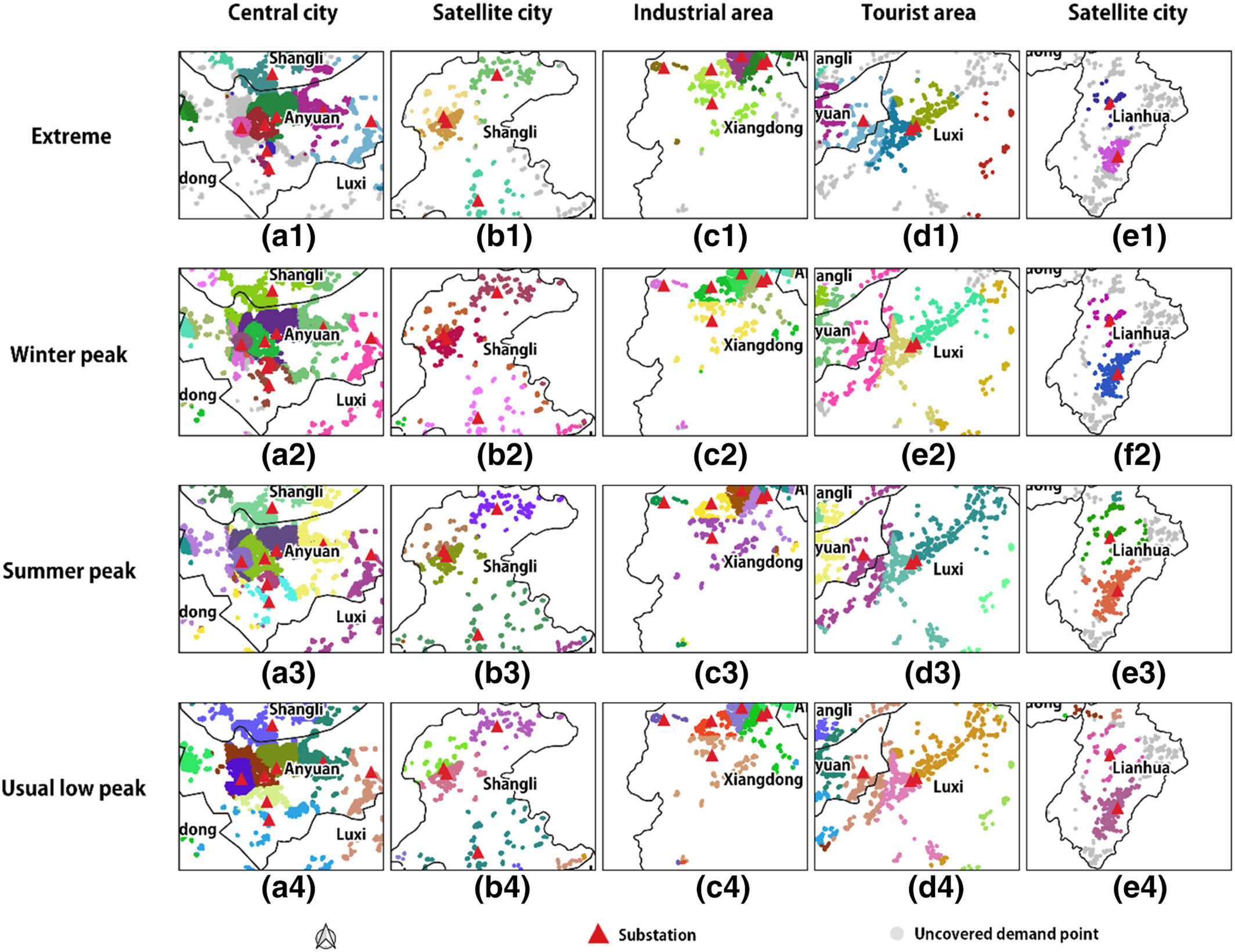
A site selection framework for urban power substation at micro-scale using spatial optimization strategy and geospatial big data
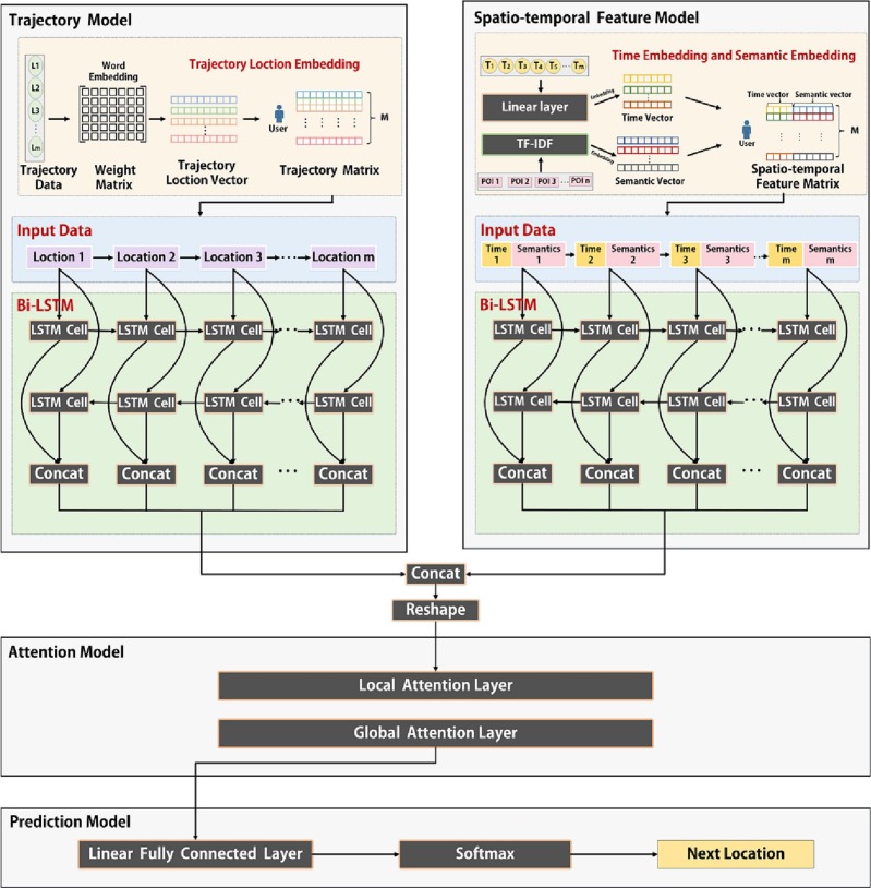
Title: Predicting mobile users' next location using the semantically enriched geo-embedding model and the multilayer attention mechanism
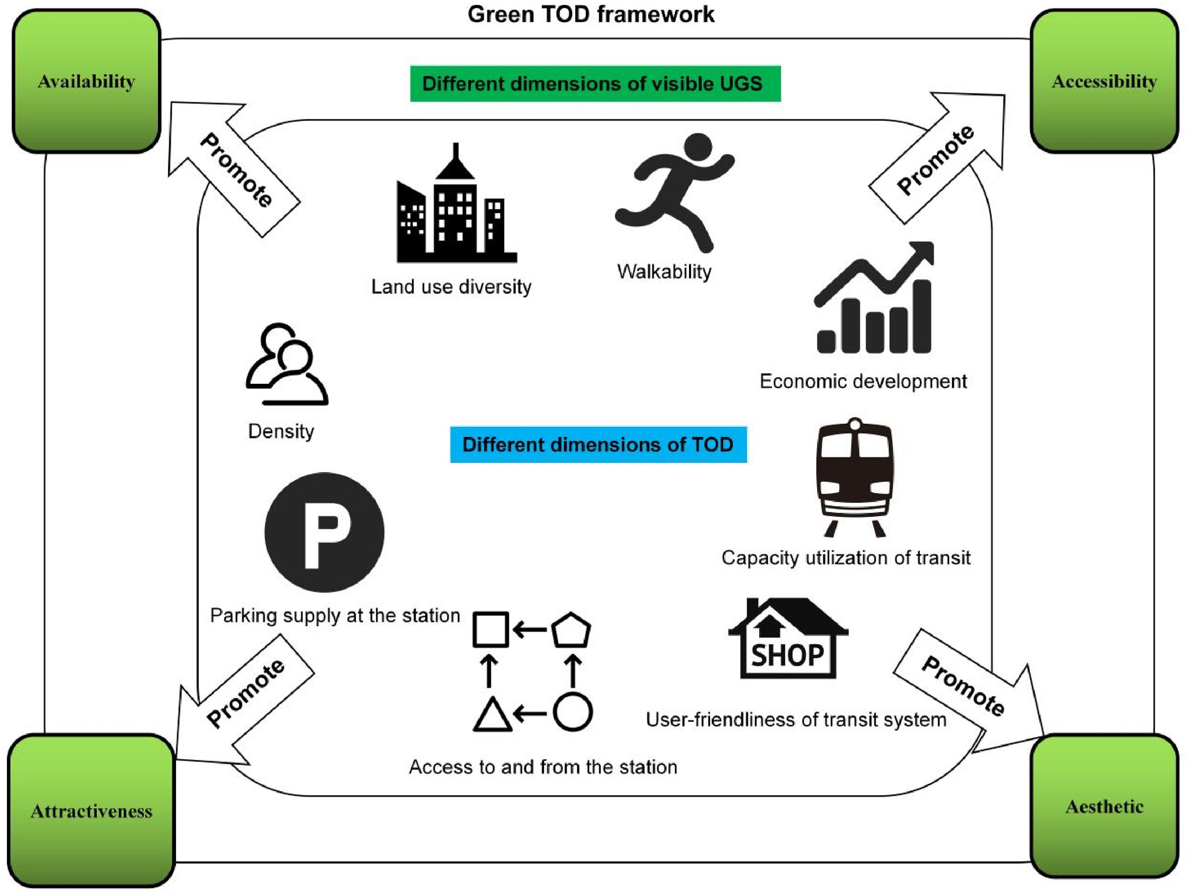
Title: “Green transit-oriented development”: Exploring the association between TOD and visible green space provision using street view dataAbstractEnv
Associations between streetscape characteristics at Chinese adolescents’ activity places and active travel patterns on weekdays and weekends
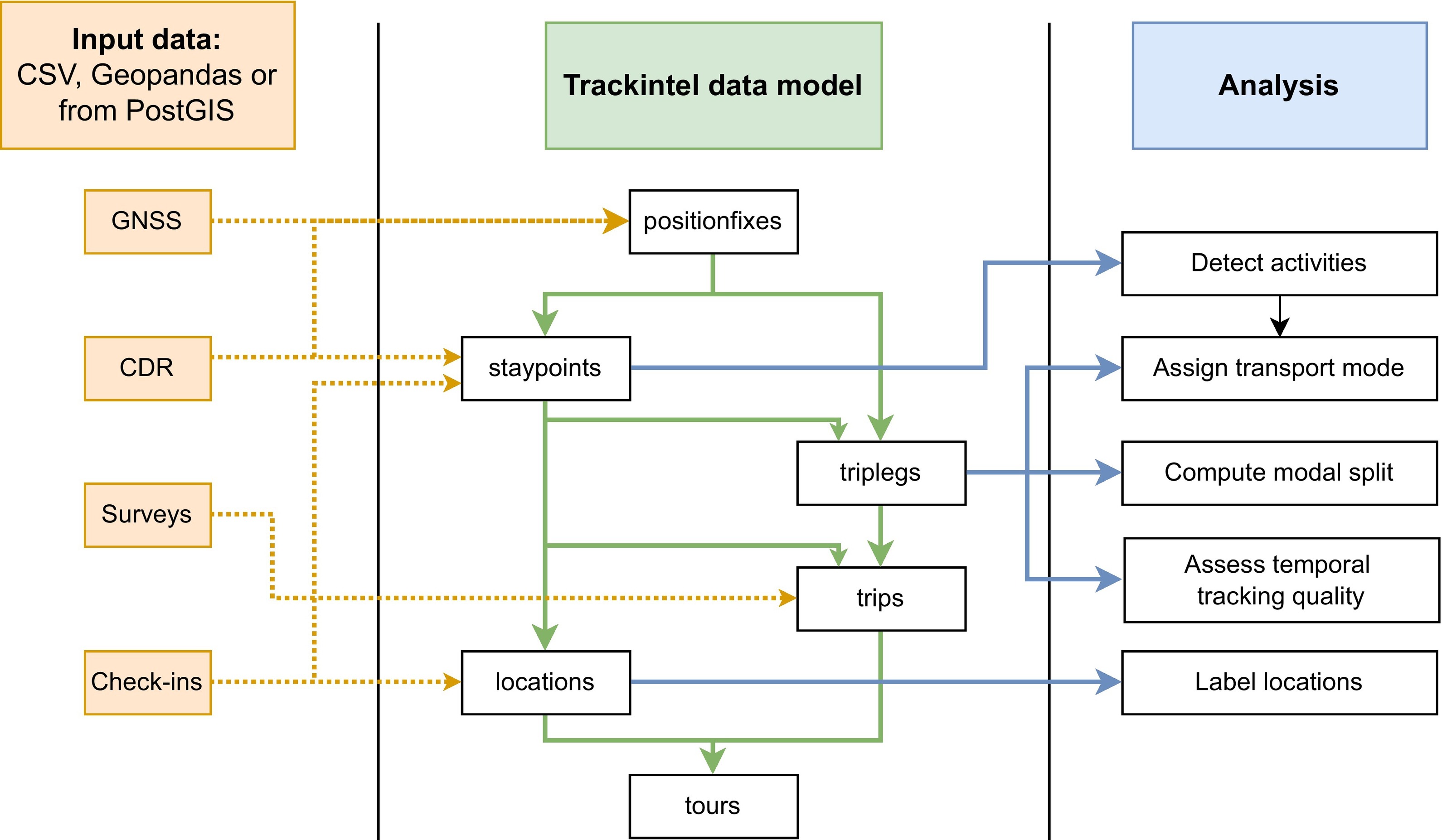
Trackintel: An open-source Python library for human mobility analysis
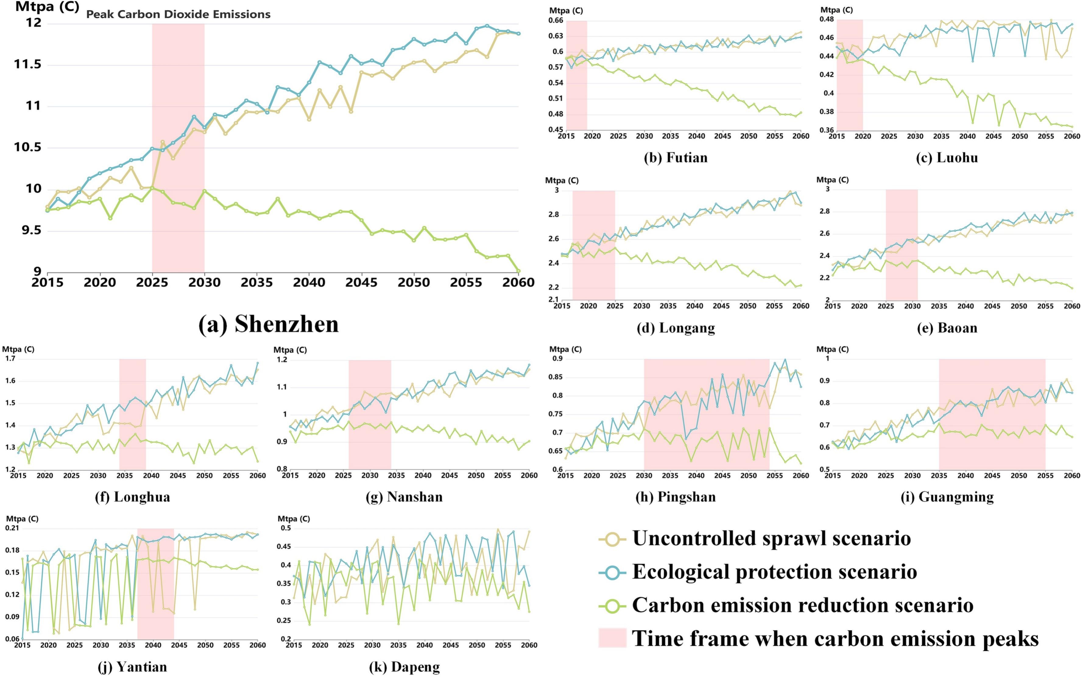
Title: CarbonVCA: A cadastral parcel-scale carbon emission forecasting framework for peak carbon emissions
Title: Gauging urban resilience in the United States during the COVID-19 pandemic via social network analysis
UrbanComp
![]()
![]()
![]()