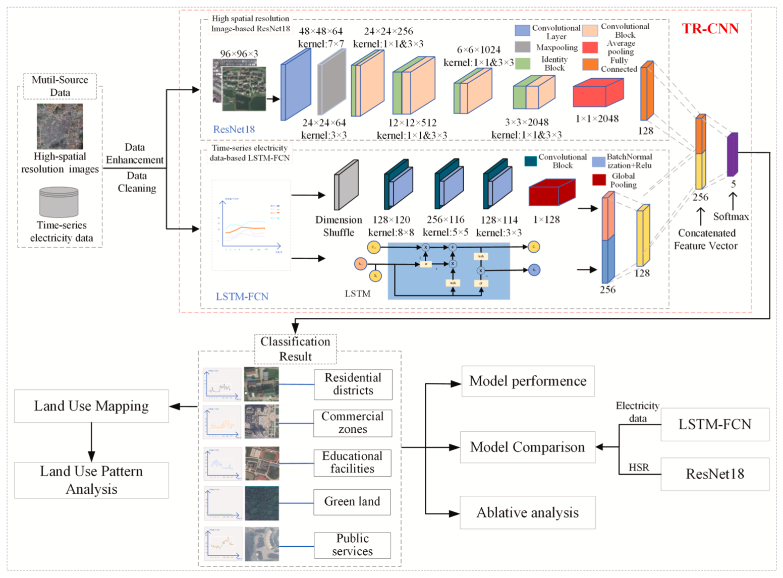
Classifying land-use patterns by time-series electricity data and remote sensing imagery
HighlightsA deep learning model (TR-CNN) for land-use classification at fine scale is proposed.TR-CNN can fuse multi-source features from HSR and elec


HighlightsA deep learning model (TR-CNN) for land-use classification at fine scale is proposed.TR-CNN can fuse multi-source features from HSR and elec

Highlights- Provision of parkland is positively associated with mental well-being during the COVID-19 epidemic.- The geographical distance to Wuhan ci
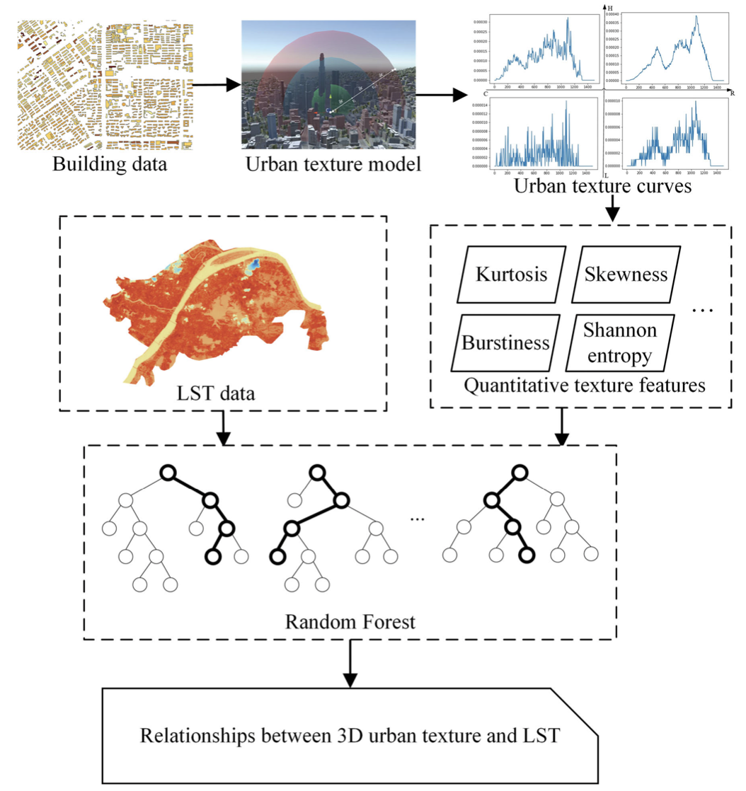
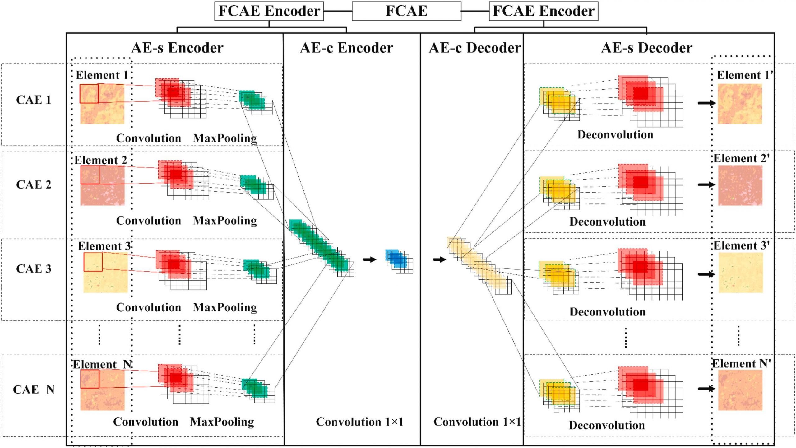
下载地址:AbstractThe spatial distribution of buildings is one of the key factors influencing the local environment within a city. The quantitative measure

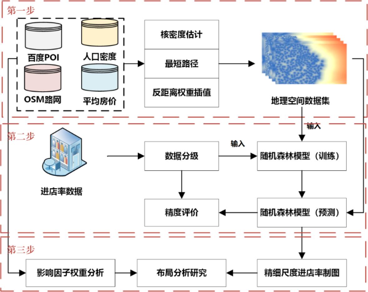
论文下载摘要新型冠状病毒肺炎的迅速传播和扩散警示着疾病风险评估的重要性。但现有的风险评估方法受数据限制,缺少实时性和准确性。此外,多数研究以行政统计单元作为分析尺度,存在可变面元问题。为解决这些问题,耦合精细尺度下武汉市疫情数据及多源地理数据,基于随机森林算法构建社区尺度的市域疫情传播风险评估模型并
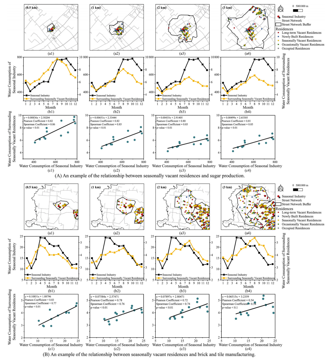
AbstractUnprecedented urbanization in China has directly resulted in residential vacancies, which has seriously stunted sustainable development, a pa
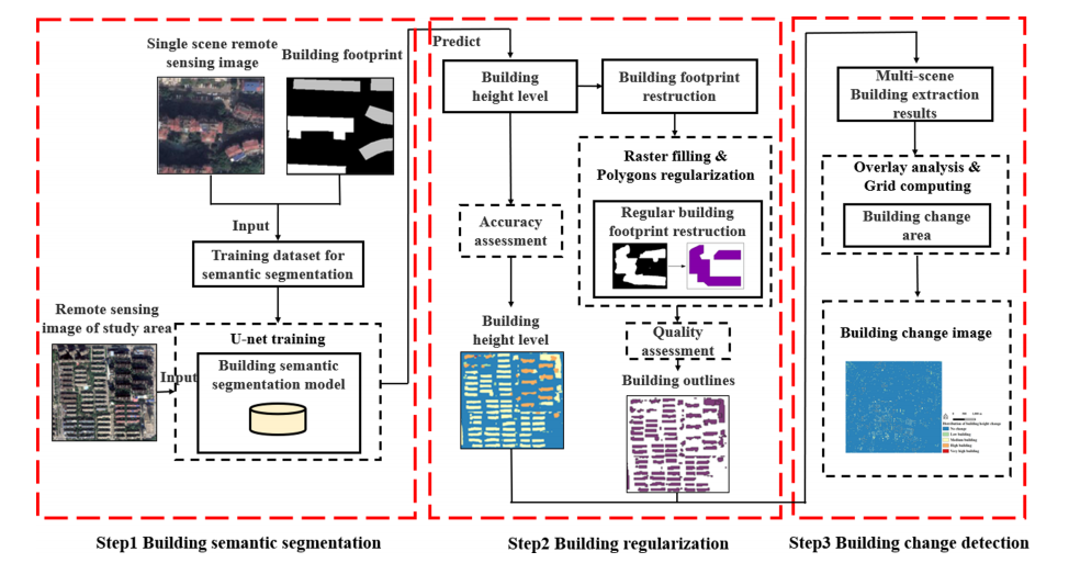
ABSTRATResearches on the urban development and urban planning have an urgent need for building geographic data. Traditional methods of extracting buil
ABSTRATThe spatial structural features and compositional relationships of multivariate geochemicals are influenced by complex geological processes (e.
摘要合理进行线下广告牌投放位置的选择,对商家宣传品牌以及扩大营销市场具有十分积极的作用。由于商业数据较难获取,以往研究多停留在宏观理论层面,未能对线下广告选址的实际布局进行细尺度分析。本研究以北京为研究区,通过耦合某大型家装品牌户外广告到店转化率和路网、感兴趣点数据(point of interes
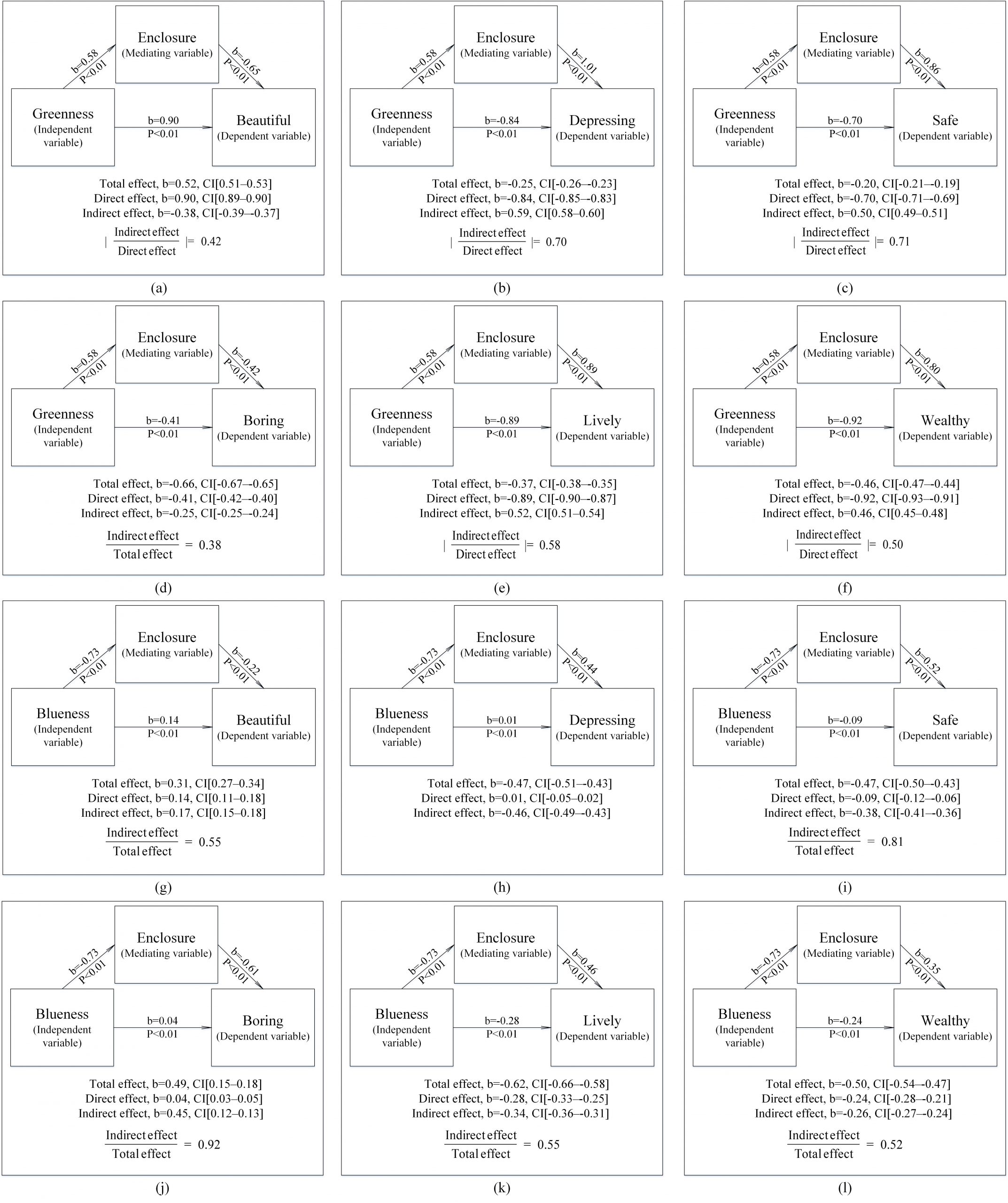
ABSTRACTAlthough previous studies have assessed the relationships between visual space indicators and urban residents’ psychological perceptions, syst
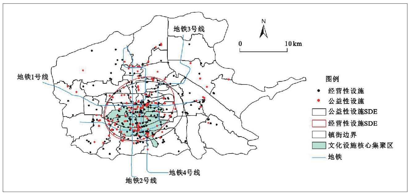
摘要选取 2019 年文化设施 POI 数据,采用标准差椭圆分析、最邻近指数和核密度估计相结合的方法,首先测度了西安市文化设施的空间集聚特征,进一步基于区位选址理论,结合空间权重矩阵的思想,对比分析了高效化要素和均等化要素对西安市文化设施集聚空间的影响。研究发现 :第一,西安市文化设施呈较为明显的空
UrbanComp
![]()
![]()
![]()