路虽远行则将至,事虽难做则必成。漫漫长路,必见曙光。《荀子•修身》
高性能空间计算智能实验室(HPSCIL)内部PPT模板
AbstractPPT模板版权为中国地质大学(武汉)高性能空间计算智能实验室所有。下载地址:HPSCIL模板_2018
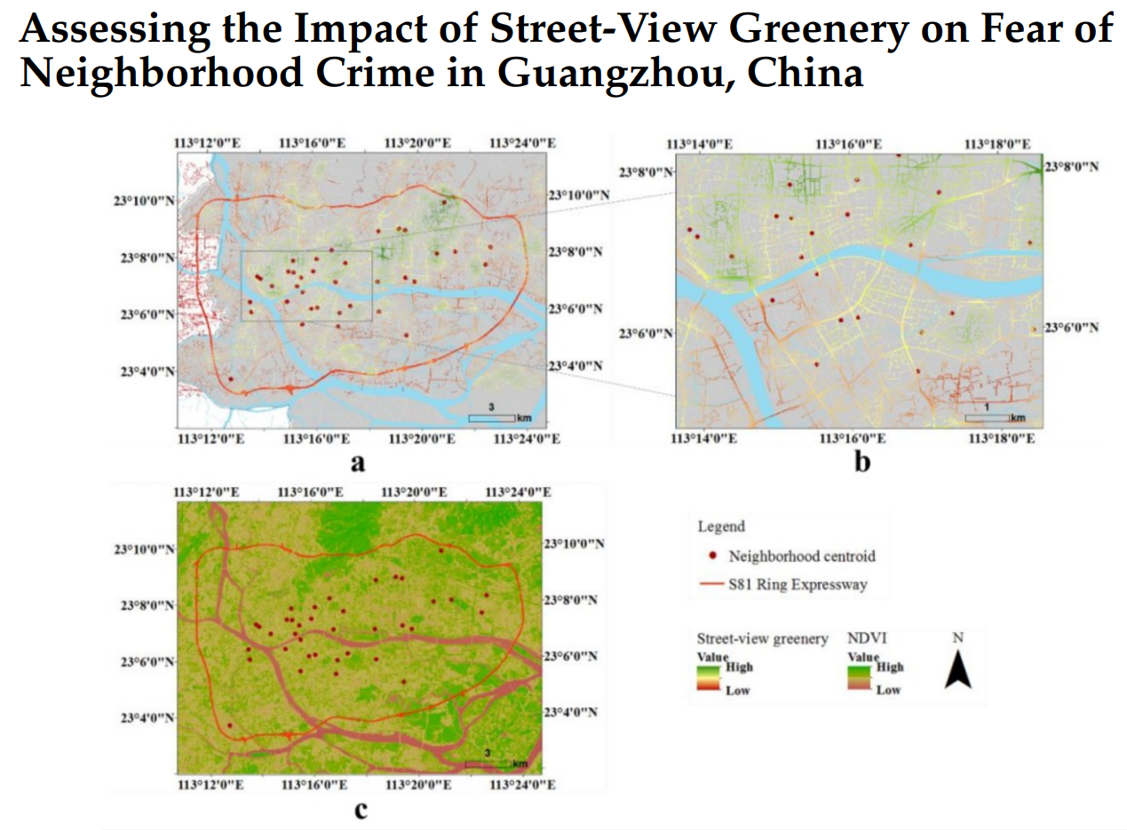
Assessing the Impact of Street-View Greenery on Fear of Neighborhood Crime in Guangzhou, China
摘要针对高分辨率遥感影像中地物的复杂性和多变性带来的地物提取难点,提出了一种基于多层次规则的面向对象的典型地物提取方法。改进了基于区域增长的影像分割方法,利用小区域内的全局最优策略进行初始增长,避开了种子点的选择。利用影像分割得到的影像对象作为地物提取的基元,针对影像上典型地物选择提取特征 ,利用多
软件著作权 | SuperCuger测量平差和可视化系统软件
SuperCuger测量平差系统是一款基于测绘工程中边角网、测角网、测边网、水准网测量数据的可视化平差系统。可用于测绘工程中测量平差计算、平差结果报告生成。同时具备平差数据可视化,便于动态查看测量平差数据及其精度评定,并拥有平差结果输出(Esri Shape File)功能。
软件著作权 | GeoCA城市发展过程模拟系统软件
登记号:2020SR1759753下载地址GeoCA v2.4: Geographical Simulation App via Pixel-based Cellular Automata
一种基于深度学习的地外天体巡视器障碍物分割方法
本发明实施例提供一种基于深度学习的地外天体巡视器障碍物分割方法,该方法包括:利用地外天体巡视器获得的图像集及其对应的人工标注图集形成样本集;将所述样本集中的样本分成训练样本、验证样本和测试样本;基于VGGNet卷积网络和U-Net网络构建神经网络;将所述训练样本和所述验证样本输入所述神经网络,对神经网络进行训练得到训练模型;利用所述训练模型对所述测试样本进行测试,得到地外.天体的障碍物分割结果。该方法将精度高的VGG网络局部迁移到本发明网络,在提高了障碍物分割精度的同时还提高了分割速度,可以满足地外天体巡视器实时性需求。

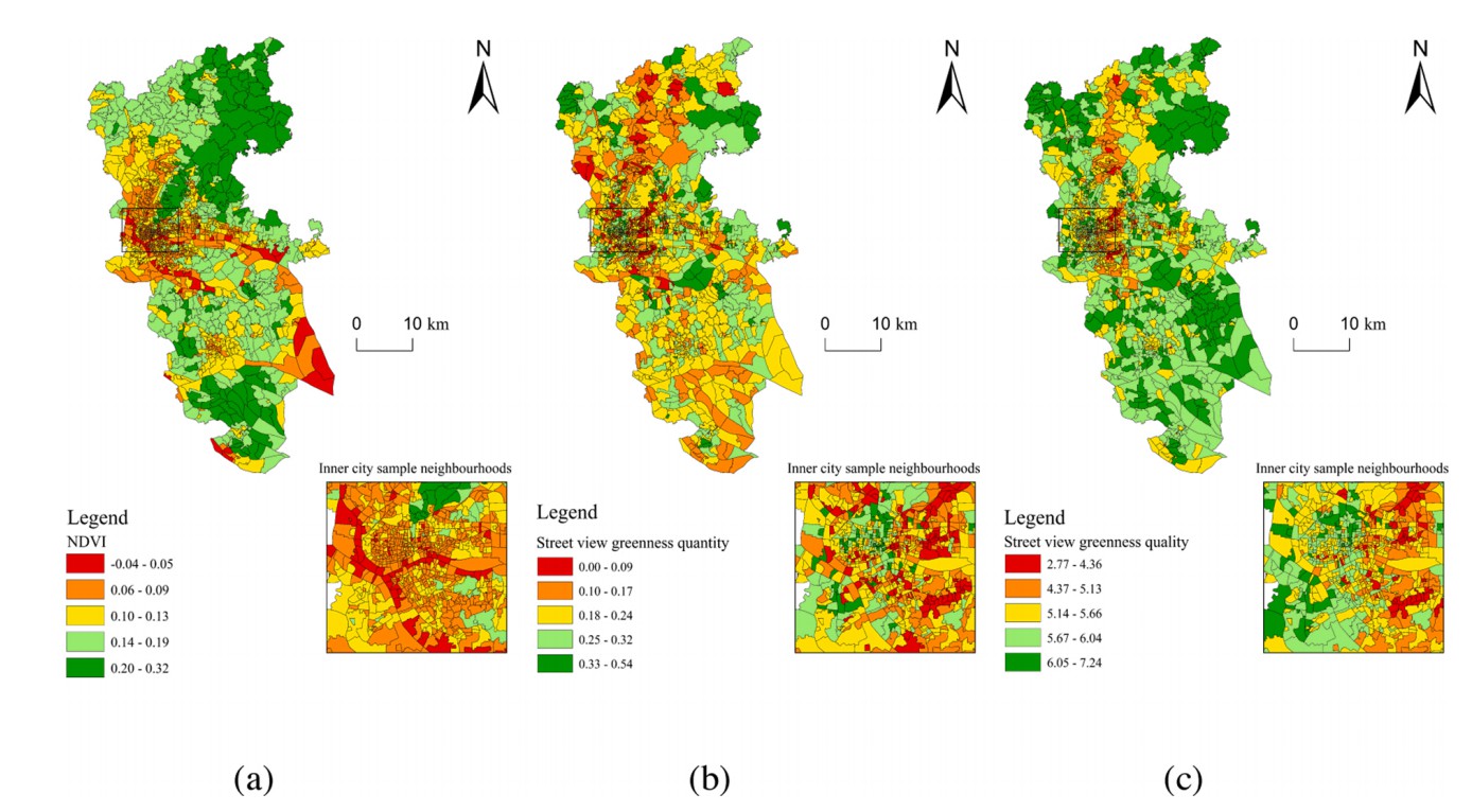
The distribution of greenspace quantity and quality with socioeconomic conditions in Guangzhou
Awareness is mounting that urban greenspace is beneficial for residents’ health. While a plethora of studies have focused on greenspace quantity, scant attention has been paid to greenspace quality. Existing methods for assessing greenspace quality is either highly labor-intensive and/or prohibitively time-consuming. This study develops a new machine learning method to assess greenspace quality based on street view images collected from
Guangzhou, China. It also examines whether greenspace exposure disparities are linked to the neighbourhood socioeconomic status (SES). The validation process indicated that our scoring system achieved high accuracy for predicting street view-based greenspace quality outside the training data. Results also show that there were marked differences in spatial distribution between aggregated NDVI (Normalized Difference Vegetation Index), street view greenness quantity and quality. Regression models show that neighbourhood SES is not associated with NDVI. Although neighbourhood SES is associated with both street view greenness quantity and quality index value, street view greenness quality is more sensitive to the change of neighbourhood SES. Our work suggests that policymakers and planners are advised to pay more attention to greenspace quality and greenspace exposure disparities in urban area.
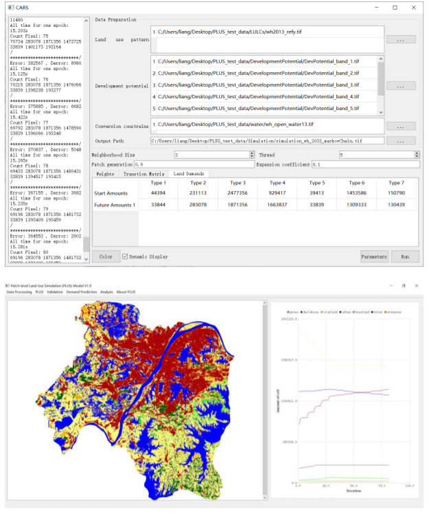
Understanding the drivers of sustainable land expansion using a land use simulation model
Understanding the drivers of sustainable land expansion using a patch-generating land use simulation (PLUS) model: A case study in Wuhan, China
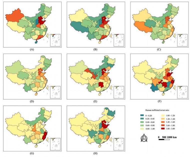
Spatiotemporal distribution of human trafficking and predicting locations of missing persons
AbstractIn China, the illegal adoption of missing persons and especially of missing children is a major public safety issue that affects social and fa
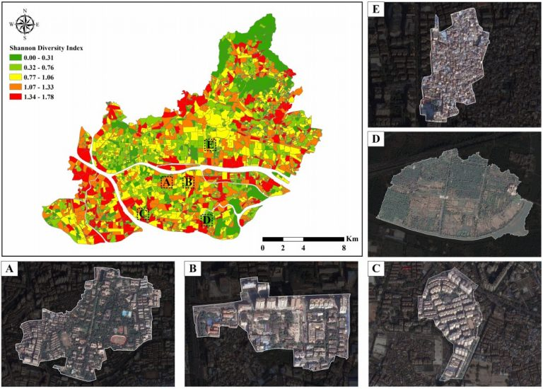
Estimation of Proportion of Land Use at Street Level by Integrating HSR Images and Geospatial Data
AbstractMixed land use has been widely used as a planning tool to improve the functionality of cities. However, depicting mixed land use is rather dif
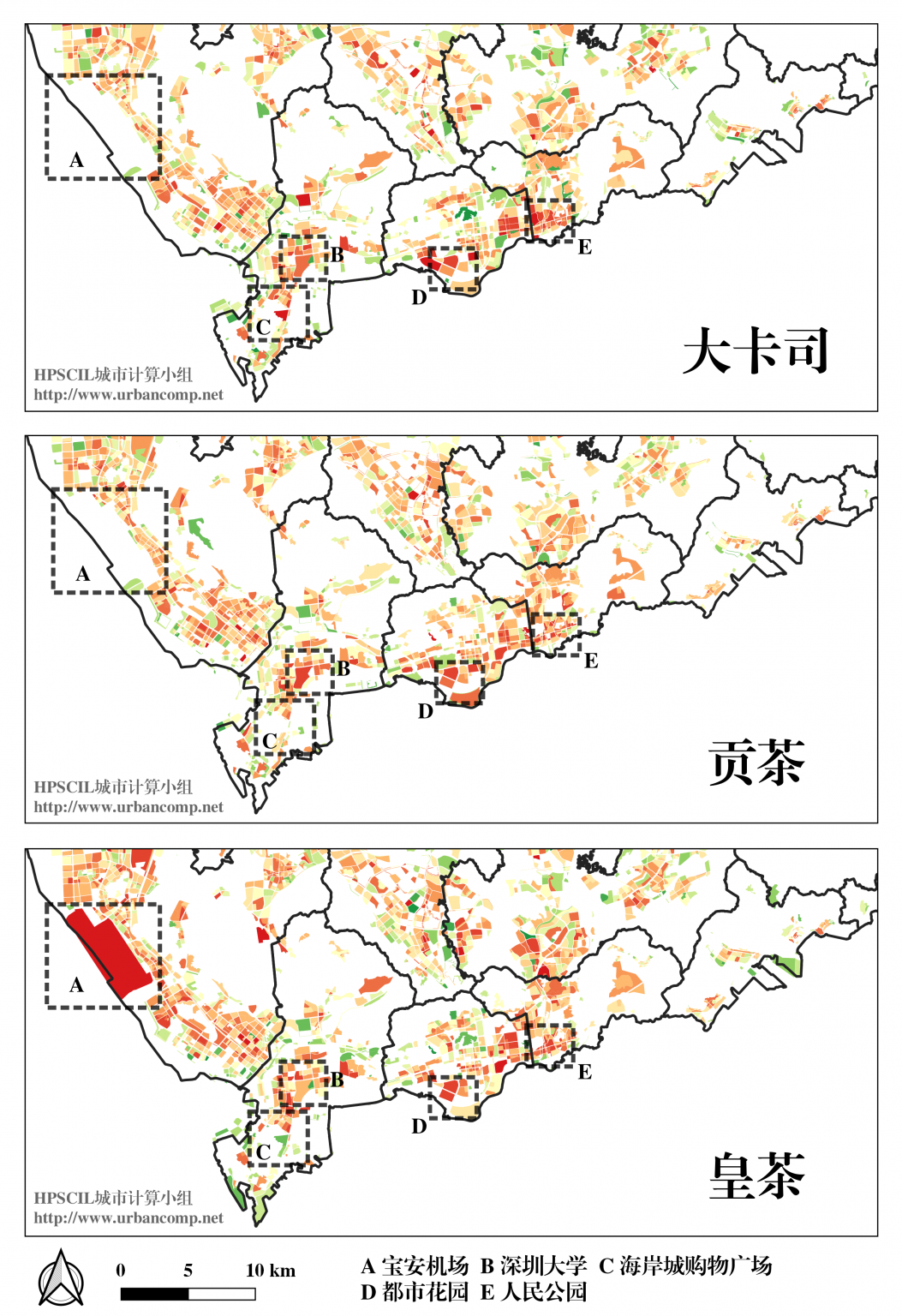
“冷启动”问题下的跨城市连锁店铺选址服务即将发布
什么是商业连锁店铺的"冷启动"问题呢?What is a commercial chain store "cold start" site selection problem?举个例子,如果在一个城市里,我需要开一家连锁店铺(比如"星巴克"


