路虽远行则将至,事虽难做则必成。漫漫长路,必见曙光。《荀子•修身》
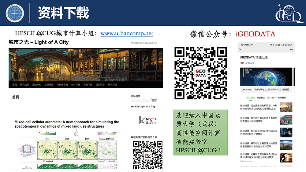
《大数据和城市计算》课程资料(2020秋季学期更新完毕)
课程介绍城市化进程赋予我们现代化的生活,但同时也带来了很多问题和挑战,如空气污染、交通拥堵、能耗增加和规划落后等。由于城市环境极其复杂,要解决这些问题在很多年前看来几乎不太可能。近年来,随着感知技术和计算环境的成熟,各种大数据在城市里悄然而生,如交通流、气象数据、道路网、兴趣点、移动轨迹和社交媒体等
HPSCIL城市计算小组 C/C++命名规范及注意事项
C++编程规范(CUG版)window.onload = function (){ var success = new PDFObject({ url: "pdf/CGVET22-08-2011V2P.pdf" ,pdfOpenParams: { scrollbars: '0', toolba
地理元胞自动机和城市模拟理论学习资料
元胞自动机(Cellular Automata,简称CA)是一种基于微观个体的相互作用空间离散动态模型,其强大的计算功能、固有的平行计算能力、高度动态及空间概念等特征,使它在模拟空间复杂系统的时空动态演变研究具有较强的优势。本资料为地理元胞自动机和城市模拟学习资料。如有问题请和我们团队联系。团队最新
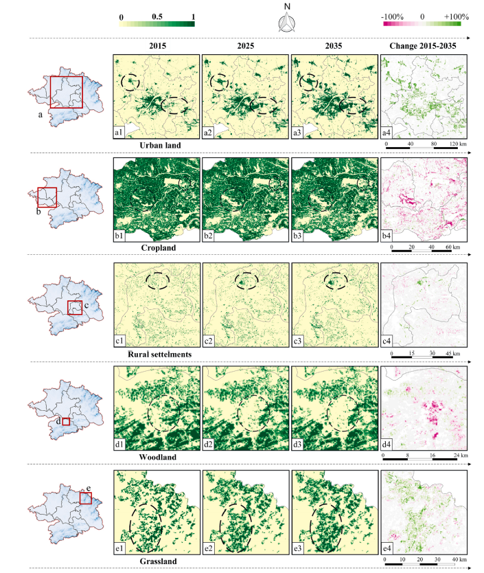
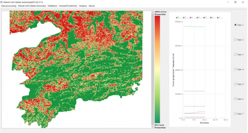
Mixed-cell cellular automata: Simulating the spatiotemporal dynamics of mixed land use structures
AbstractWhen used for land use change modeling, Cellular Automata (CA) usually assume that each cell has only one land use type at each time step, ign
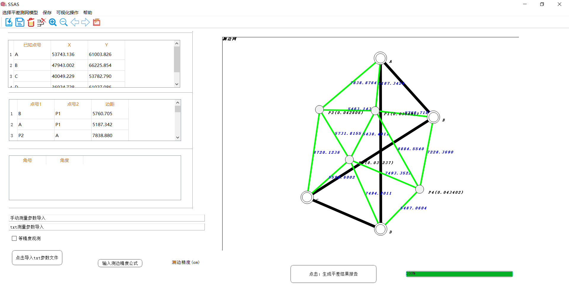
SuperCuger 测量平差系统 V1.0(SuperCuger Surveying Adjustment System V1.0)
SuperCuger测量平差系统是一款基于测绘工程中边角网、测角网、测边网、水准网测量数据的可视化平差系统。可用于测绘工程中测量平差计算、平差结果报告生成。同时具备平差数据可视化,便于动态查看测量平差数据及其精度评定,并拥有平差结果输出(Esri Shape File)功能。软件主体界面下载链接gi
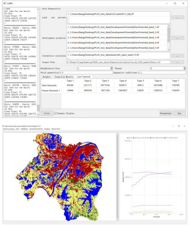
斑块级土地利用变化模拟模型(Patch-level Land Use Simulation Model,PLUS)
PLUS模型是一个基于栅格数据的可用于斑块尺度土地利用/土地覆盖(LULC)变化模拟的元胞自动机(CA)模型。PLUS模型集成了基于土地扩张分析的规则挖掘方法和基于多类型随机种子机制的CA模型,可用于挖掘土地扩张的驱动因素并预测土地利用景观的斑块级演化。下载链接https://github.com/
混合元胞CA模型及软件 (Mixed-cell cellular automata, MCCA)
传统的元胞自动机(CA)用于土地利用变化模型时,通常假设每个像元在每次迭代上都只含有一种土地利用类型。但这样会忽略土地单元中常常存在的混合土地利用结构。MCCA模型是基于混合像元运行的,混合像元由多种土地利用类型的覆盖比例组成,可以更好地表达土地利用的连续变化,并为混合土地利用结构的时空动态建模提供
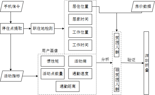
深圳折叠:基于手机信令大数据的贫困人群精准识别和时空分布研究
Abstract相对于农村贫困,城市贫困人口的分布情况和活动模式有着更多的可变性,不同经济水平人群的社会隔离现象尤为明显。本研究基于深圳市手机信令数据,构建精细用户画像。耦合深圳市房价分布与用户画像精准识别贫困人群和非贫困人群。通过对两类人群的时空分布和活动模式的分析,揭示贫困人群在城市内的活动模式
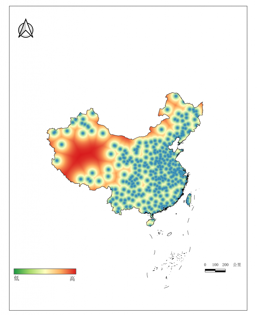
基于腾讯时序人口数据和深度长短记忆网络的中国政府扶贫效率研究项目
Abstract2020 年是中国政府制定的全面脱贫元年。之前的研究指出,腾讯时序人口数据可以有 效反应区域经济水平,并据此构建了精细尺度的中国贫困空间分布和预测模型,而如何准 确地评估"十三五"规划中扶贫政策的有效性成为了亟待解决的问题。本研究拟采用两期 腾讯时序人口数据,结合