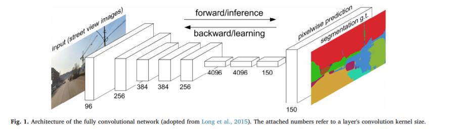
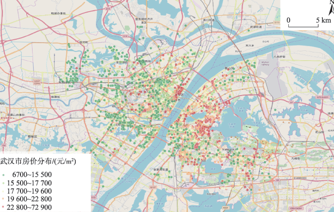
卷积神经网络和随机森林的城市房价微观尺度制图方法 研究成果 ABSTRATChina’s rapid urbanization has caused a large number of migrants to move to the city, which has also led to housing shortages. Rapid access to
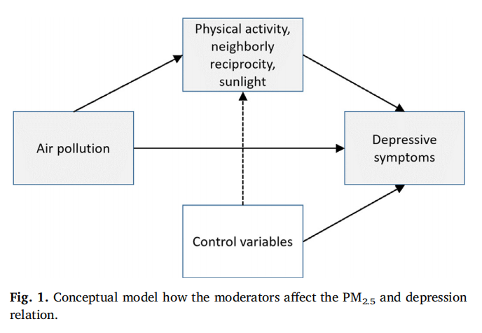
Cross-sectional associations between long-term exposure to particulate matter and depression 研究成果 ABSTRATBackground: Although numerous studies have speculated about the direct and indirect linkage between longterm air pollution (i.e., PM2.5) concen
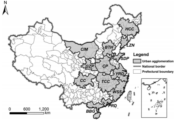
Detecting clusters over intercity transportation networks 研究成果 ABSTRATIntercity transportation infrastructures and services determine the depth and breadth of the spatial interactions among cities within an urban
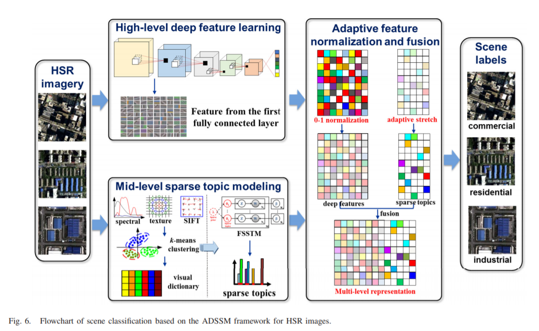
Deep Sparse Semantic Modeling Framework for High Spatial Resolution Image Scene Classification 研究成果 AbstractHigh spatial resolution (HSR) imagery scene classification, which involves labeling an HSR image with a specific semantic class according to t
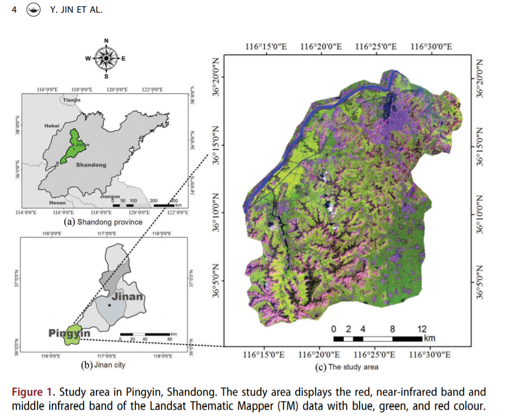
Land-cover mapping using Random Forest and incorporating NDVI time-series and texture 研究成果 AbstractLand-cover mapping in complex farming area is a difficult task because of the complex pattern of vegetation and rugged mountains with fast-flo
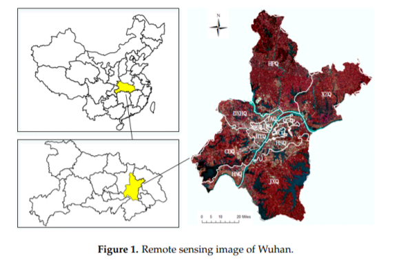
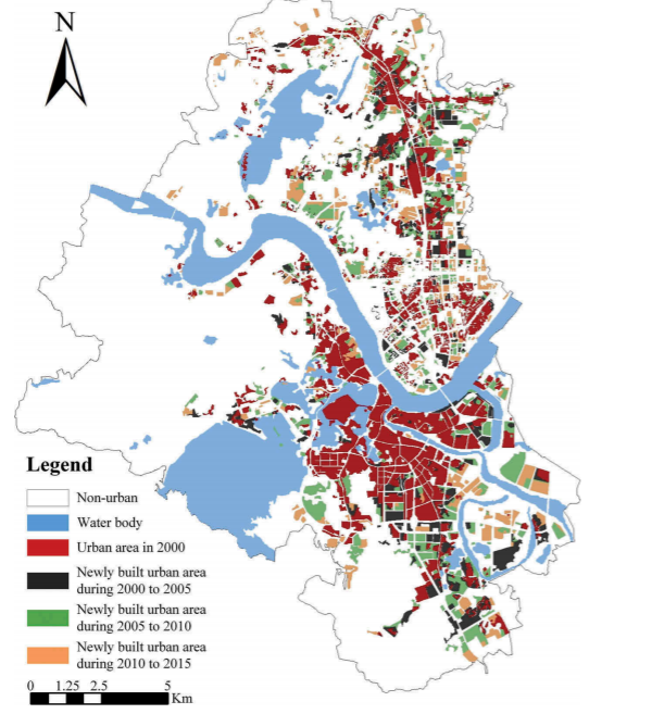
Temporal and Spatial Analyses of the Landscape Pattern of Wuhan City Based on Remote Sensing Images 研究成果 AbstractWith the acceleration of the process of building a national-level central city in Wuhan, the landscape pattern of the city has undergone treme
Multiple intra-urban land use simulations and driving factors analysis: a case study in Huicheng 研究成果 AbstractSimulations of intra-urban land use changes have gradually attracted more attention as these approaches are extremely helpful in regard to dec
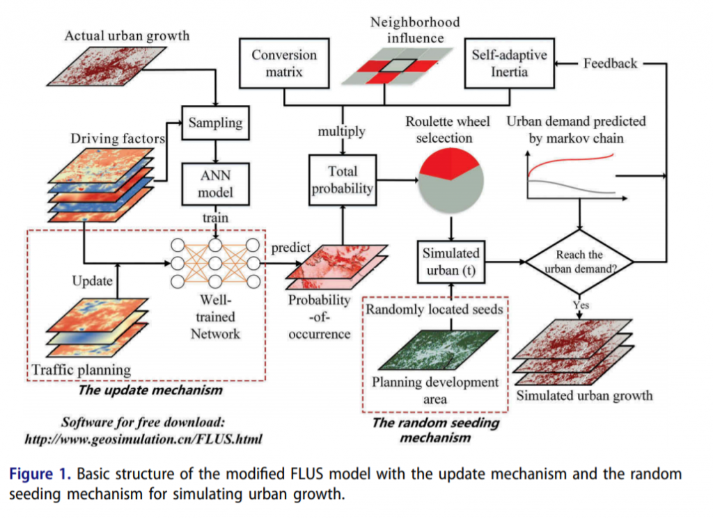
Urban growth simulation by incorporating policies into a CA-based future land-use simulation model 研究成果 AbstractUrban land-use change is affected by urban planning and government decision-making. Previous urban simulation methods focused only on planning
Mining transition rules of CA for simulating urban expansion by using the deep learning techniques 研究成果 AbstractAlong with the gradually accelerated urbanization process, simulating and predicting the future pattern of the city is of great importance to