Hierarchical community detection and functional area identification
ABSTRATAn in-depth analysis of the urban road network structure plays an essential role in understanding the distribution of urban functional area. To


ABSTRATAn in-depth analysis of the urban road network structure plays an essential role in understanding the distribution of urban functional area. To
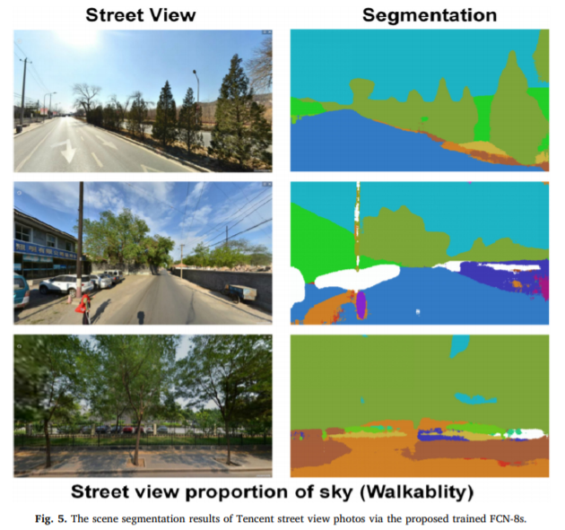
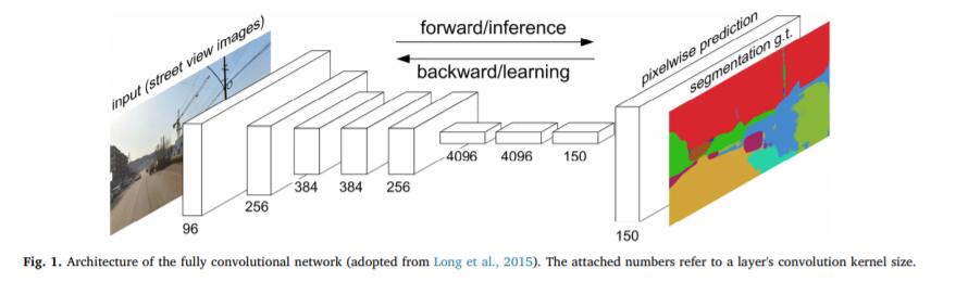
ABSTRATBackground: Neighbourhood walkability has been consistently associated with more physical activities in adults. Nevertheless, evidence of a ben
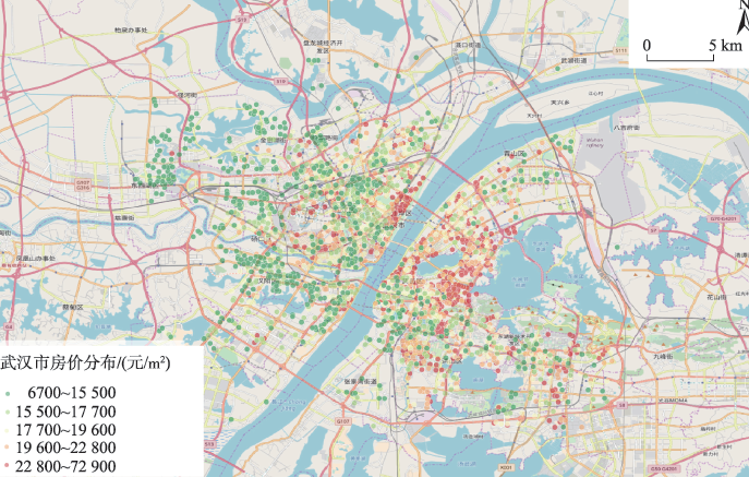
ABSTRATChina’s rapid urbanization has caused a large number of migrants to move to the city, which has also led to housing shortages. Rapid access to
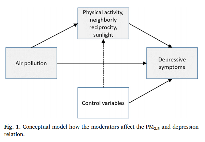
ABSTRATBackground: Although numerous studies have speculated about the direct and indirect linkage between longterm air pollution (i.e., PM2.5) concen
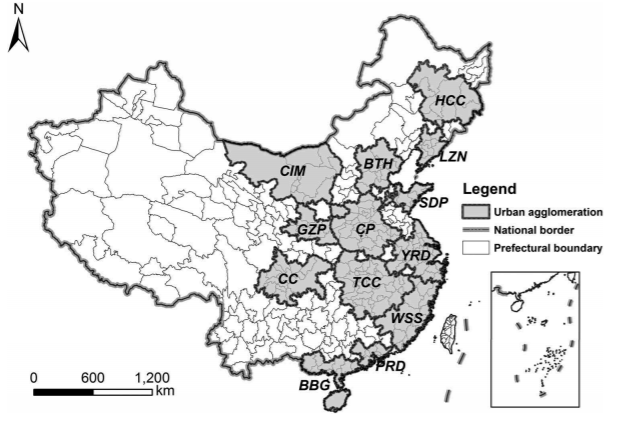
ABSTRATIntercity transportation infrastructures and services determine the depth and breadth of the spatial interactions among cities within an urban
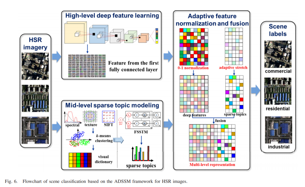
AbstractHigh spatial resolution (HSR) imagery scene classification, which involves labeling an HSR image with a specific semantic class according to t
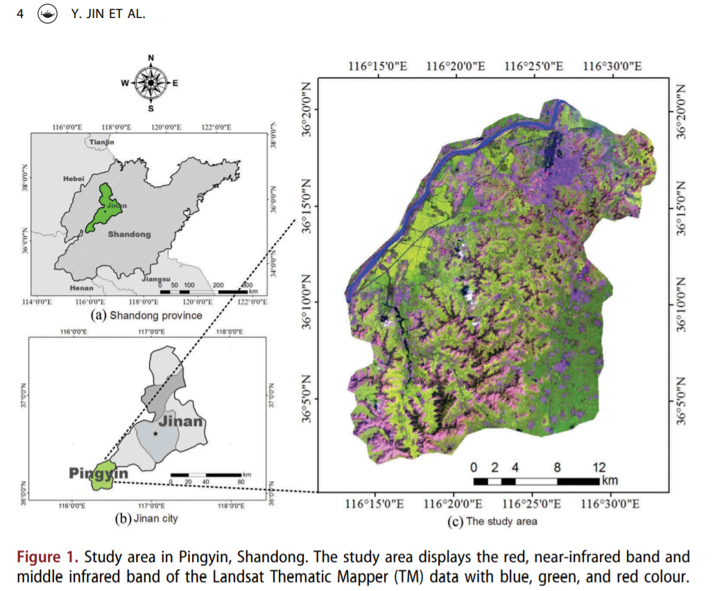
AbstractLand-cover mapping in complex farming area is a difficult task because of the complex pattern of vegetation and rugged mountains with fast-flo
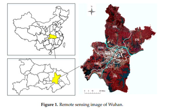
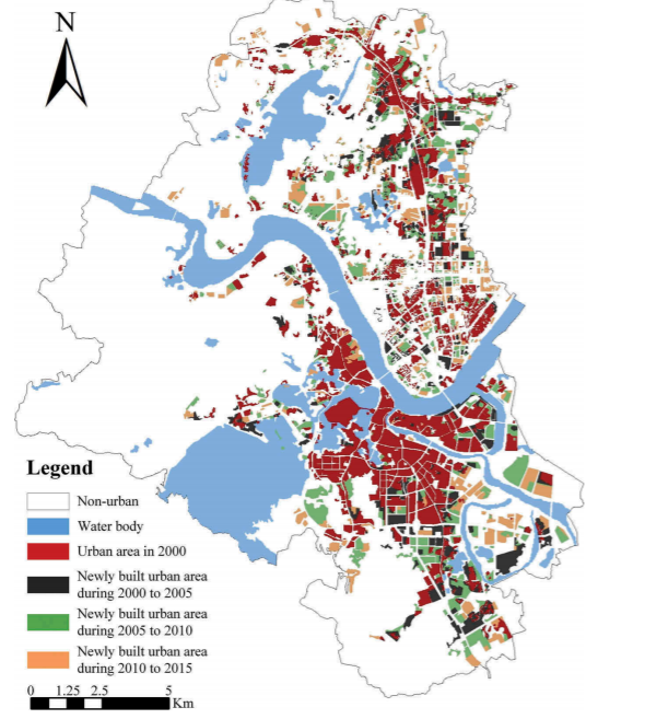
AbstractWith the acceleration of the process of building a national-level central city in Wuhan, the landscape pattern of the city has undergone treme
AbstractSimulations of intra-urban land use changes have gradually attracted more attention as these approaches are extremely helpful in regard to dec
UrbanComp
![]()
![]()
![]()