会议通知 | 第五届空间数据智能学术会议SpatialDI 2024 投稿延期 新闻通知 为进一步促进空间数据智能研究的理论发展与应用,交流相关领域的新理论、新问题、新方法,ACM SIGSPATIAL中国分会创办了空间数据智能学术会议(SpatialDI)。
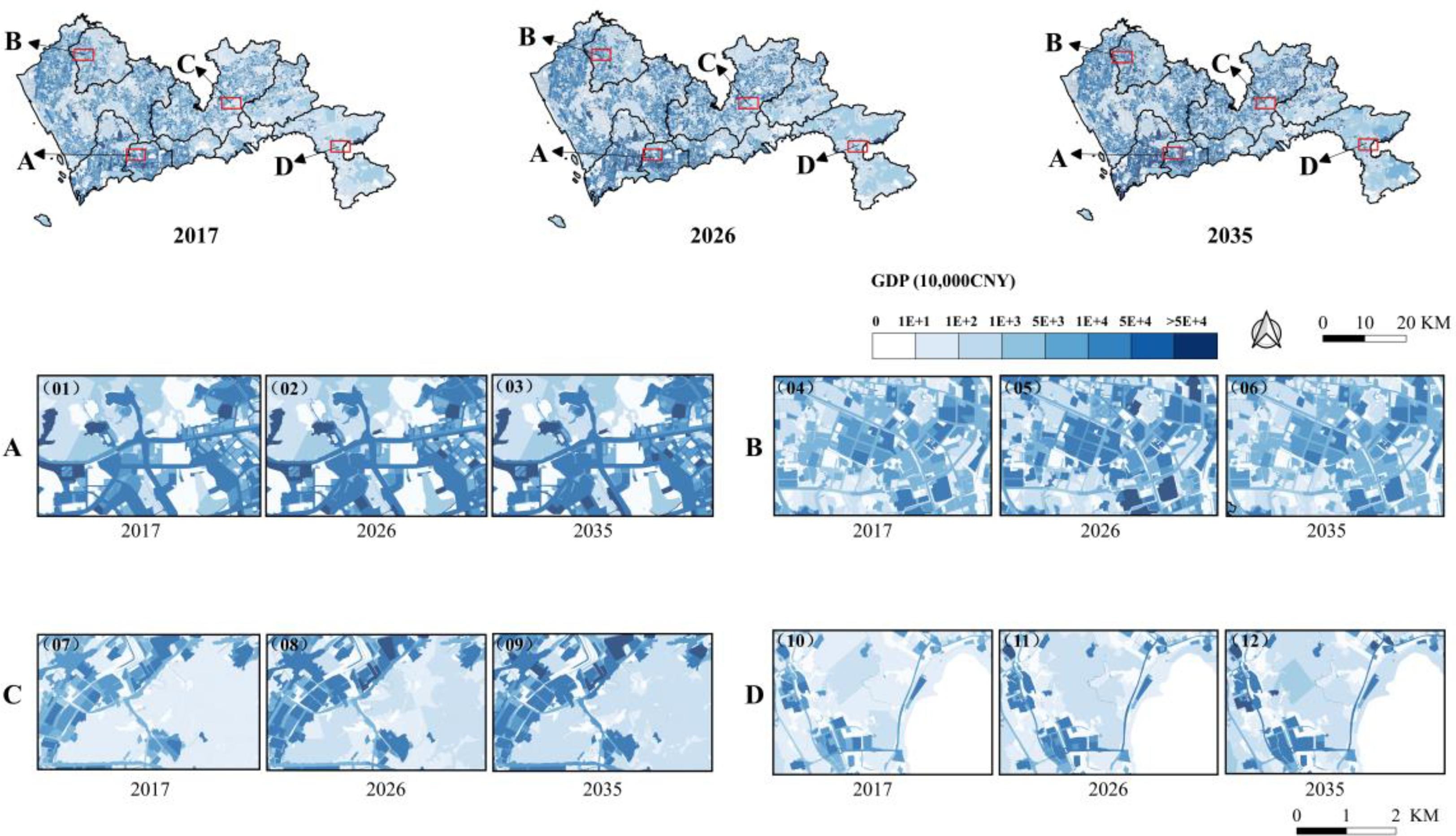
Fine-grained regional economic forecasting for a megacity using vector-based cellular automata 研究成果 Fine-grained regional economic forecasting for a megacity using vector-based cellular automata
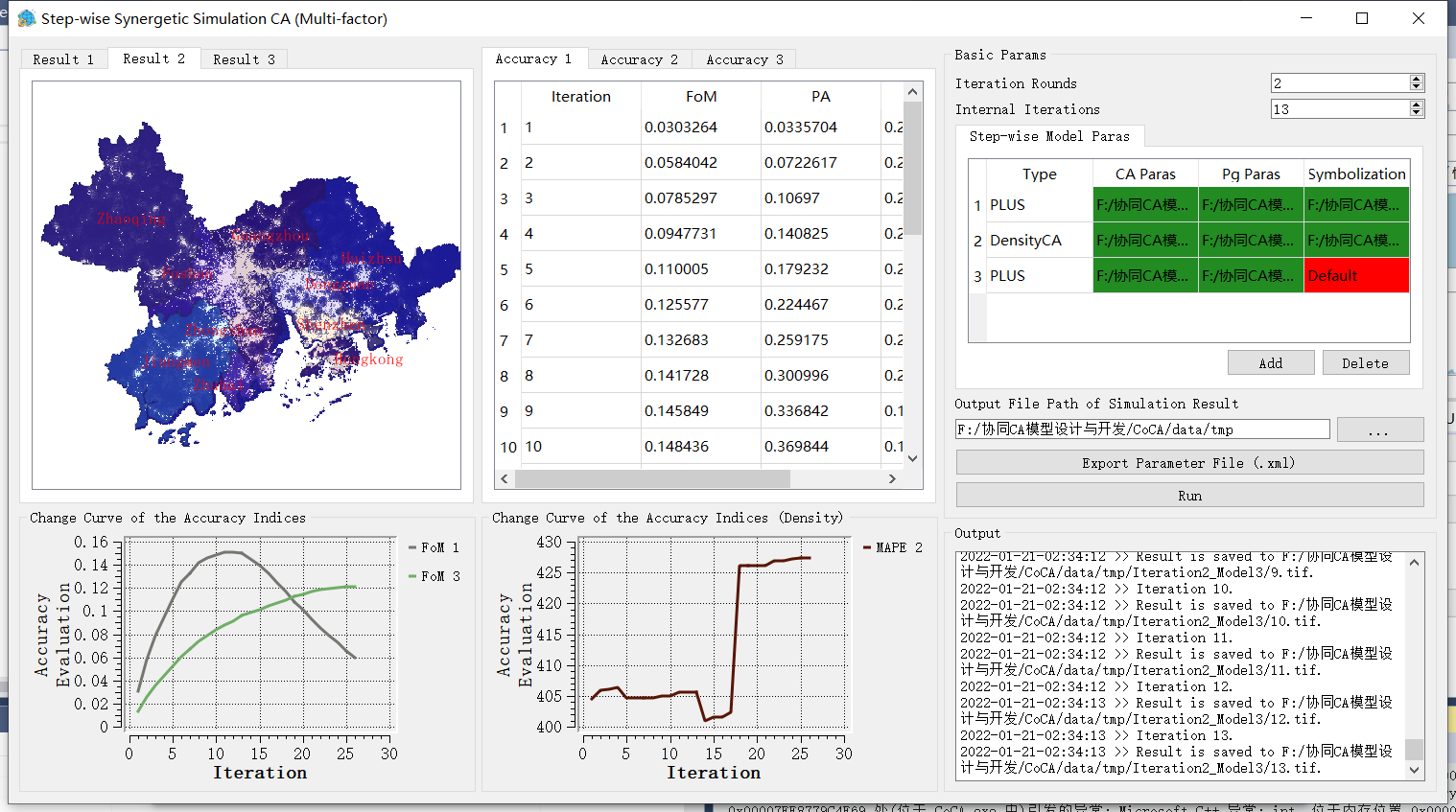
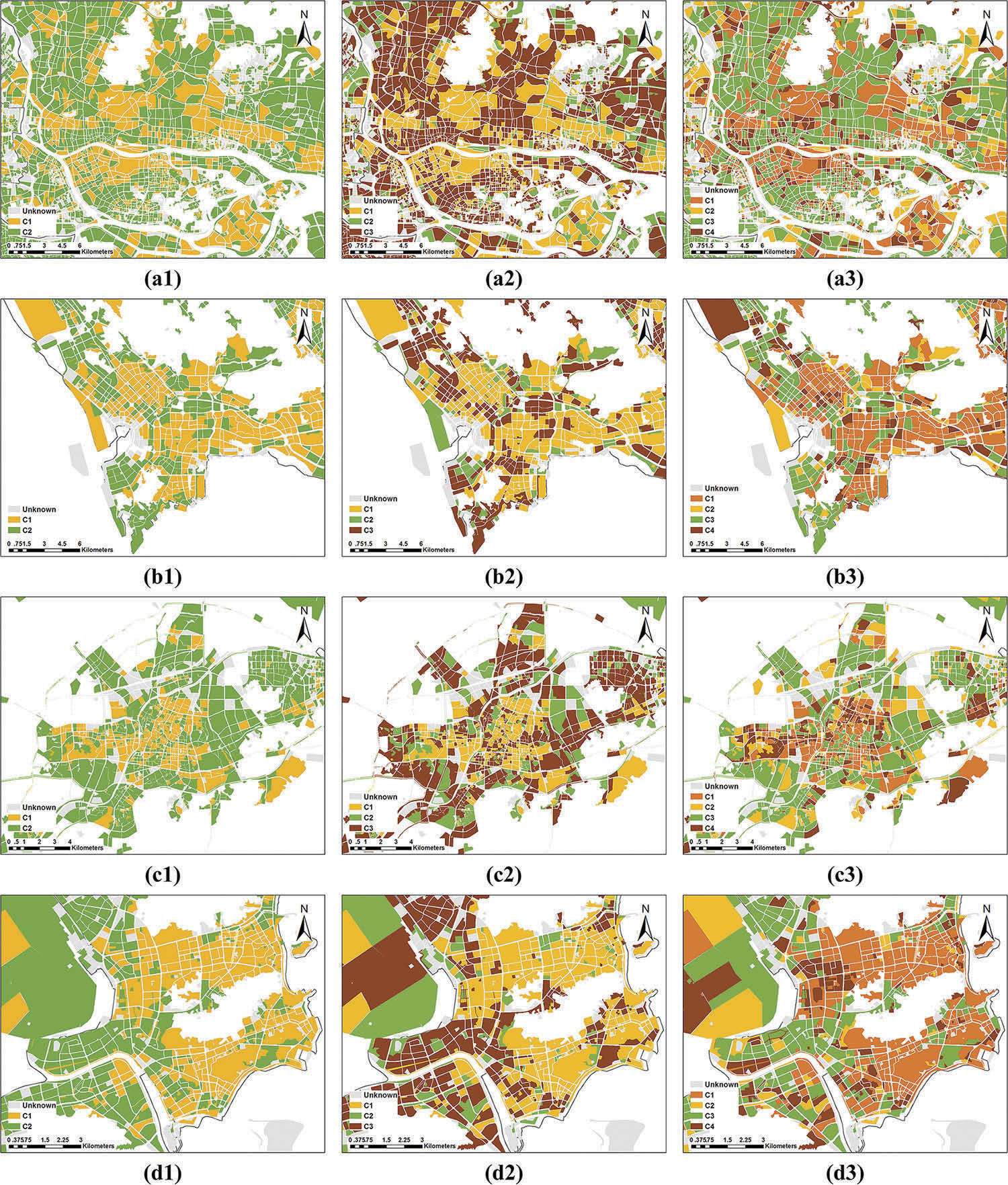
Spatial cooperative simulation of land use-population-economy in the Greater Bay Area, China 研究成果 Spatial cooperative simulation of land use-population-economy in the Greater Bay Area, China
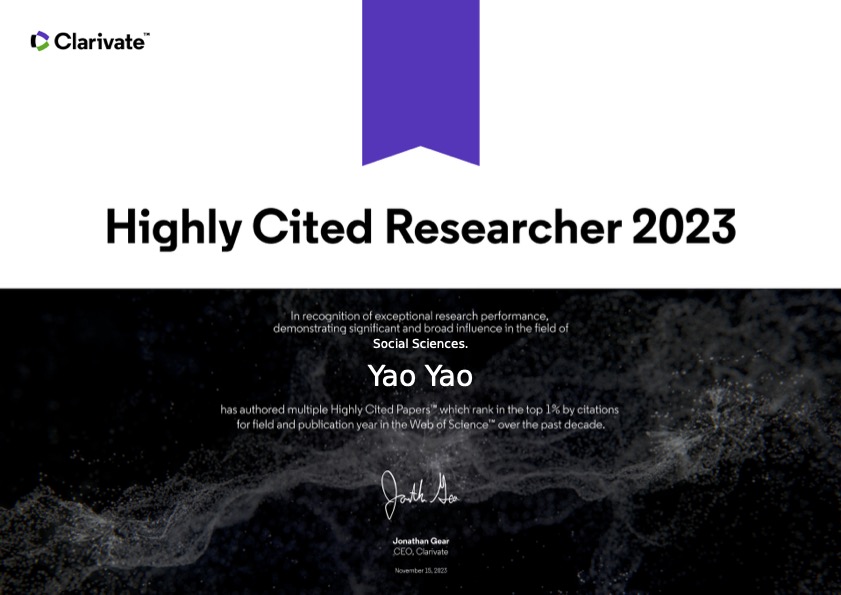
团队新闻 | 科睿唯安2023年全球高被引科学家名单发布 新闻通知 2023年11月15日,科睿唯安发布了其2023年度“高被引科学家”名单。本次名单全球共有6849位研究人员共7125人次入选。其中,我校高性能空间计算智能实验室(HPSCIL)的姚尧教授和梁迅教授成功入选。
支持兴趣点数据(POI)的空间语义分析工具 Google Word2Vec 软件下载 Google的Word2Vec是一种经典的语言模型,它从大量文本语料中以无监督学习的方式学习语义知识,把非结构化的词转换为结构化的向量。