路虽远行则将至,事虽难做则必成。漫漫长路,必见曙光。《荀子•修身》
多源空间大数据场景下的家装品牌线下广告选址布局研究
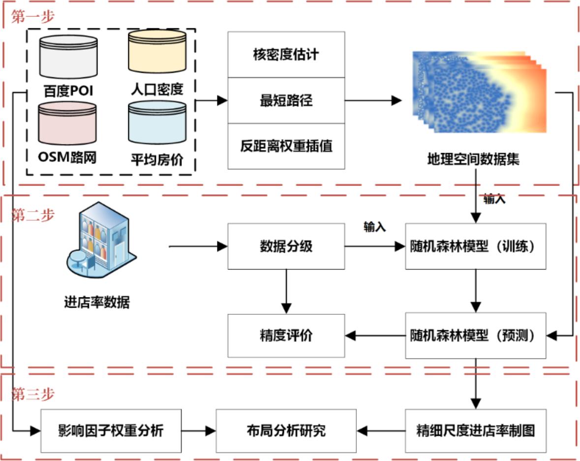
摘要合理进行线下广告牌投放位置的选择,对商家宣传品牌以及扩大营销市场具有十分积极的作用。由于商业数据较难获取,以往研究多停留在宏观理论层面,未能对线下广告选址的实际布局进行细尺度分析。本研究以北京为研究区,通过耦合某大型家装品牌户外广告到店转化率和路网、感兴趣点数据(point of interes
Analyzing correlation between visual space and residents’ psychology using images and deep learning
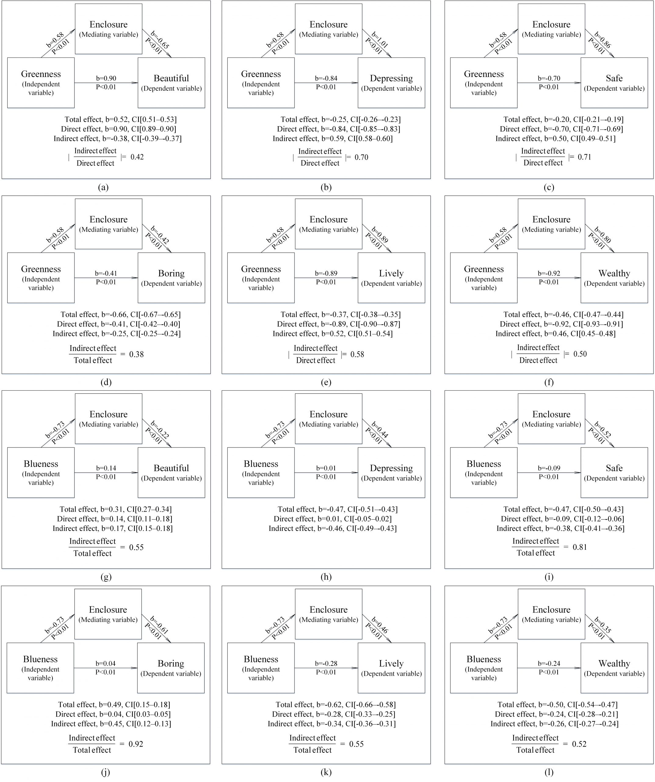
ABSTRACTAlthough previous studies have assessed the relationships between visual space indicators and urban residents’ psychological perceptions, syst
西安市文化设施的空间集聚特征及影响因素分析——倡导高效化还是侧重均等化?
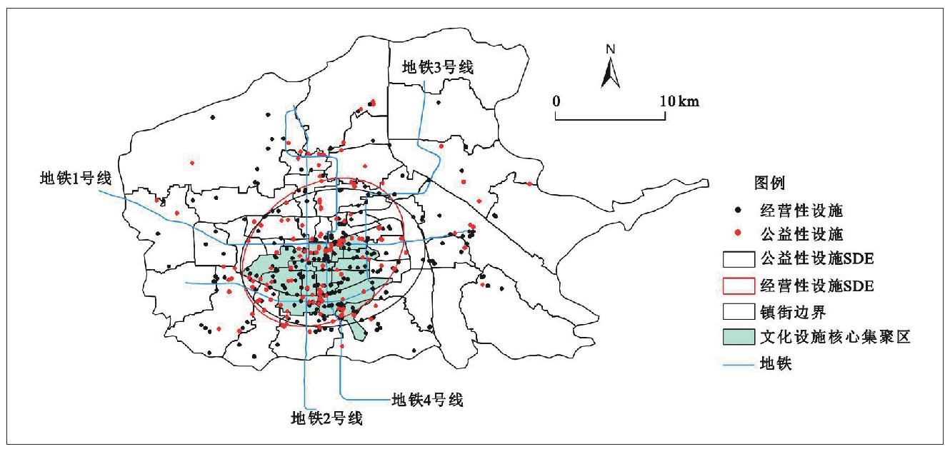
摘要选取 2019 年文化设施 POI 数据,采用标准差椭圆分析、最邻近指数和核密度估计相结合的方法,首先测度了西安市文化设施的空间集聚特征,进一步基于区位选址理论,结合空间权重矩阵的思想,对比分析了高效化要素和均等化要素对西安市文化设施集聚空间的影响。研究发现 :第一,西安市文化设施呈较为明显的空
A global North-South division line for portraying urban development
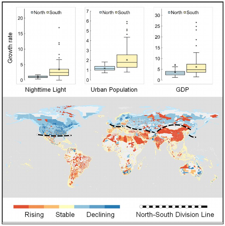
SUMMARYRapid urbanization has tremendously changed the global landscape with profound impacts on our society. Nighttime light (NTL) data can provide v
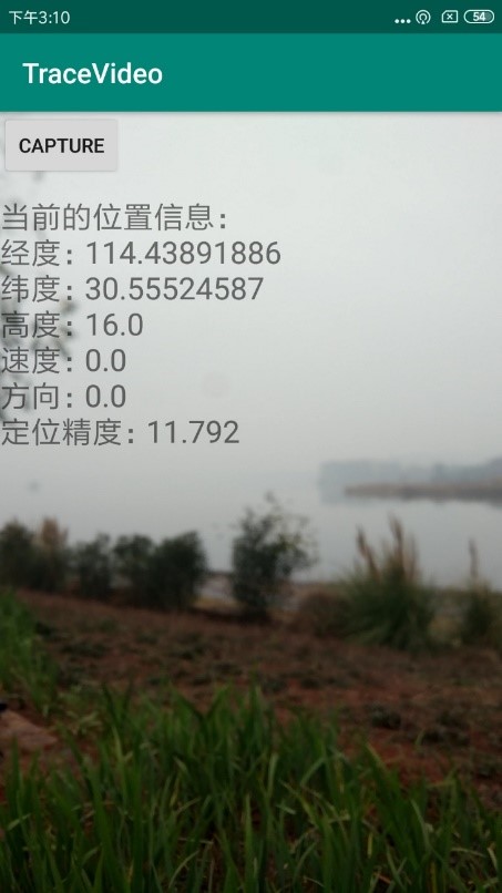
TraceVideo v2.0:带有位置信息的视频流数据采集软件(Andorid版)
TraceVideo v1.0是基于手机视频和传感器,获取位置信息和街景视频流的Android手机软件。TraceVideo v1.0会要求手机的摄像头、GPS和存储权限,在用户移动的过程中,记录视频,及视频的起始、终点时间,和视频记录时间全过程的位置信息。开发者团队研究生 王宇同学:9164910
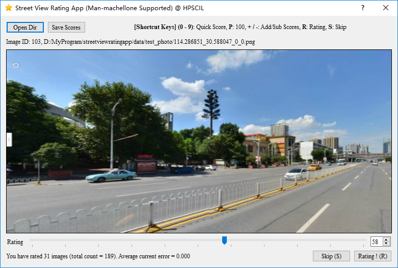
StreetViewRatings v1.0:支持人机对抗的图片打分软件(单机版)
StreetViewRatings Version 1.0是我们HPSCIL团队自主研发的支持人机对抗的图片打分软件(单机版)。StreetViewRatings Version 1.0 is an image scoring software (Standalone) that supports
基于路网数据和复杂图论的中国城市交通布局评价
摘要城市化的快速发展推动了我国城市道路网的不断扩张和发展。城市道路网是一个动态、开放、自组织的空间复杂网络,构成了城市的结构框架,研究城市道路网的结构特征对路网规划和城市建设有着重要的应用价值。在国内城市道路网络结构特征的相关研究中,很少有学者基于道路走向的视角对整个城市路网结构进行研究,也缺少对全
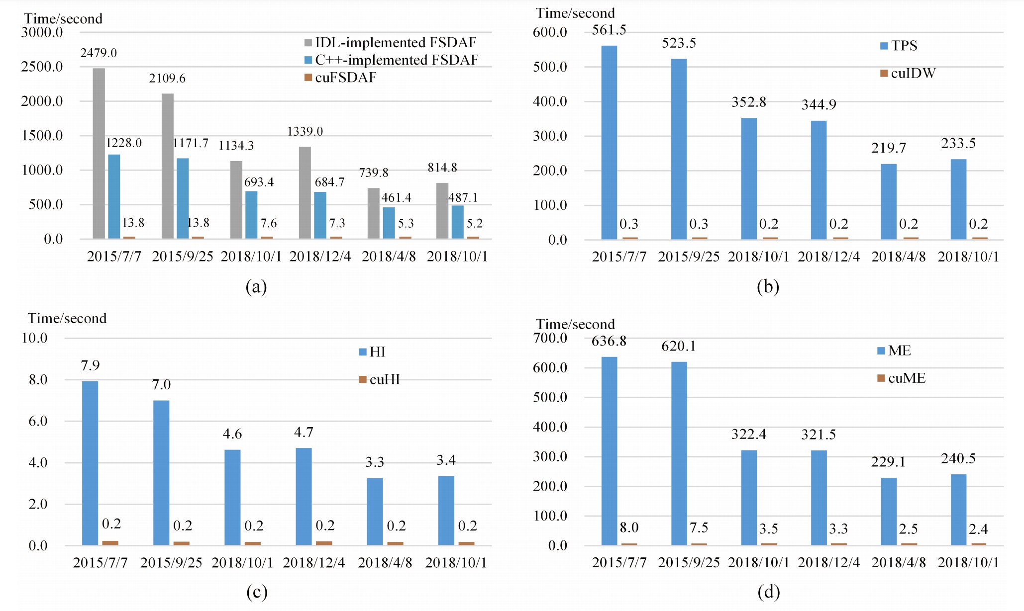
cuFSDAF: An Enhanced Flexible Spatiotemporal Data Fusion Algorithm Parallelized Using GPU
AbstractSpatiotemporal data fusion is a cost-effective way to produce remote sensing images with high spatial and temporal resolutions using multisour
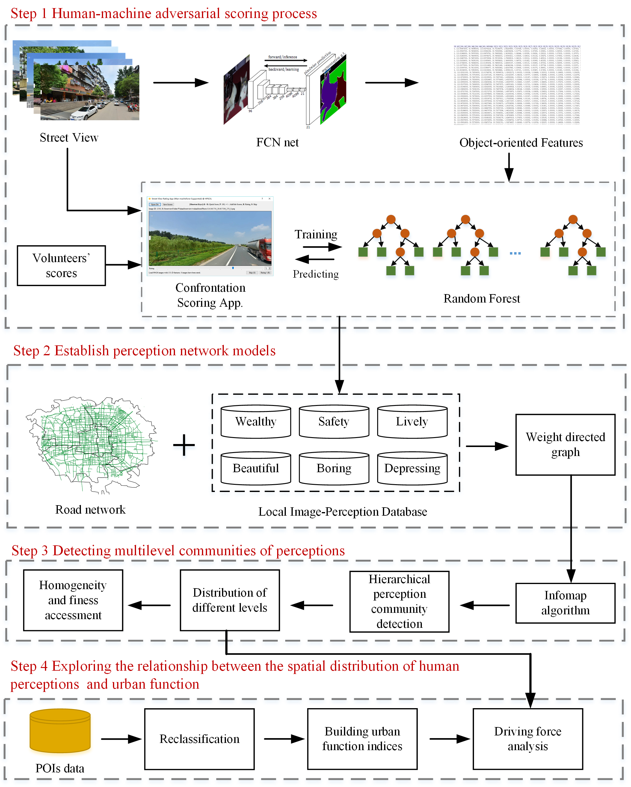
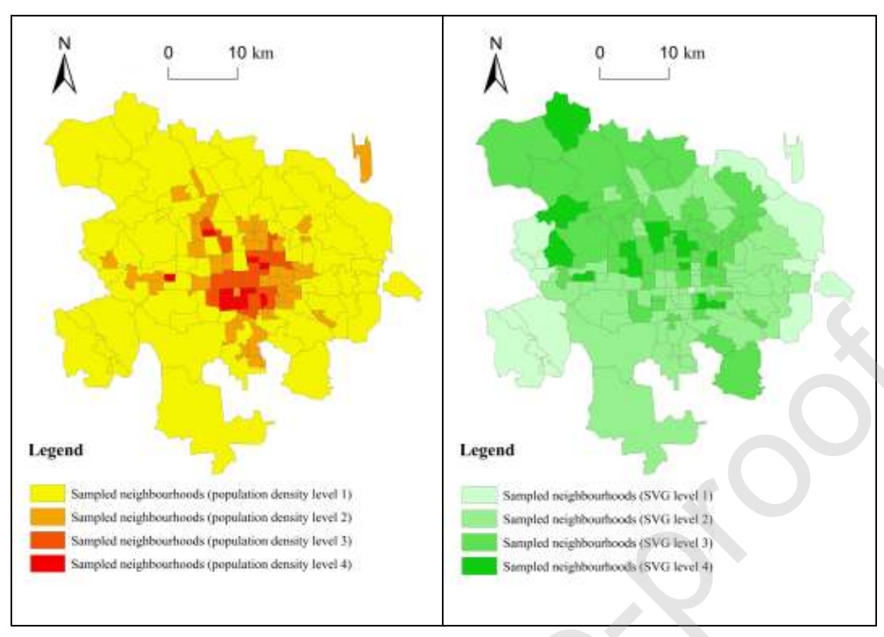
Discovering the homogeneous geographic domain of human perceptions from street view images
AbstractHuman perception of place refers to residents’ psychological feelings about urban areas. Many studies of human perceptions have focused on a s
Perceived influence of street greenness in work and residential environment on life satisfaction
AbstractSensing urban greenness from street view data offers a new and alternative way of measuring the association between greenness exposure and su