路虽远行则将至,事虽难做则必成。漫漫长路,必见曙光。《荀子•修身》
Can parkland mitigate mental health burden imposed by the COVID-19? A national study in China
Highlights- Provision of parkland is positively associated with mental well-being during the COVID-19 epidemic.- The geographical distance to Wuhan ci
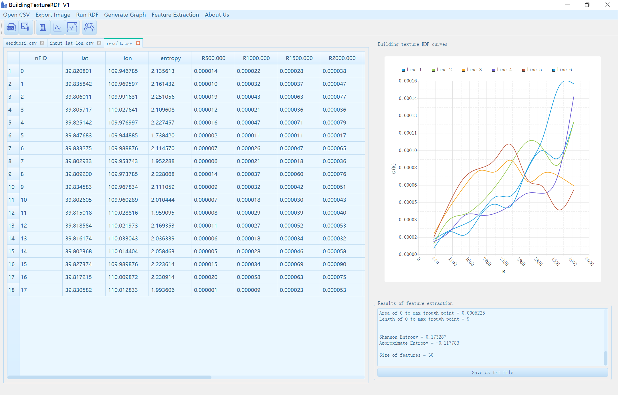
UrbanTexture v1.0:基于改进径向分布函数的三维城市纹理计算软件(PC端)
文字介绍在过去的一月里,我们正式完成了UrbanTexture的开发与测试。UrbanTexture是基于RDF三维城市纹理模型对复杂的城市形态进行数值计算和分析的系统,可以用于广泛的城市研究和应用程序(Guan et al. 2021)。This past January we officiall
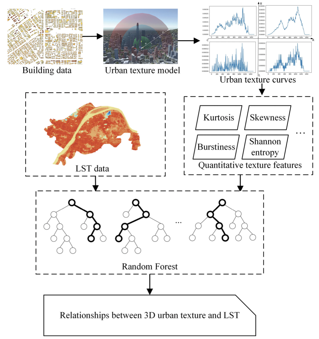
Under the Dome: A 3D Urban Texture Model and Its Relationship with Urban Land Surface Temperature
下载地址:AbstractThe spatial distribution of buildings is one of the key factors influencing the local environment within a city. The quantitative measure
新城古韵载文脉,街景感知渝人知——重庆市街区改造前后的情感感知和文化探究(视频)
研究预览温馨提示:如果发生网页加载错误错误,请直接点击链接查看:点此进入视频演示温馨提示:如果发生视频镜像错误,请直接进入bilibili查看:点此进入1. 设计思想作为全球城镇化的热点区域,截至到2020年,中国已有60.6%的人口居住在城市地区,而在未来十年城市仍将吸纳约2亿人口。随着城市现代化
基于多源地理数据精细尺度的武汉市人居环境新型冠状病毒肺炎疫情传播风险评估
论文下载摘要新型冠状病毒肺炎的迅速传播和扩散警示着疾病风险评估的重要性。但现有的风险评估方法受数据限制,缺少实时性和准确性。此外,多数研究以行政统计单元作为分析尺度,存在可变面元问题。为解决这些问题,耦合精细尺度下武汉市疫情数据及多源地理数据,基于随机森林算法构建社区尺度的市域疫情传播风险评估模型并
专题预告(二)| 第十七届中国地理信息科学理论与方法学术年会
专题报告:地理空间智能分析与计算专题主席 报告人专题报告:地理信息共享与互操作专题主席报告人专题报告:全空间信息系统原理与技术专题主席汇报人
在线讲座 | 龙瀛:主动城市感知
讲座信息主题:主动城市感知讲者:龙瀛(清华大学)主持:关庆锋(中国地质大学(武汉))时间:2021年10月13日(周三)15:00-16:00地点:腾讯会议(846 911 951)扫码进入腾讯会议:个人简介龙瀛,清华大学建筑学院研究员,博士生导师;研究兴趣包括城市空间测度、机理认知与效能提升;北京
第三届中国空间数据智能学术会议SpatialDI 2022 (一号通知)
ACM中国空间分会致力于推动空间数据的研究范式及空间智能理论与技术在时空大数据、智慧城市、交通科学、社会治理等领域的创新与应用。为进一步促进空间数据智能研究的理论发展与应用,交流相关领域的新理论、新问题、新方法,ACM中国空间分会创办了中国空间数据智能学术会议(SpatialDI)。2020年以网络
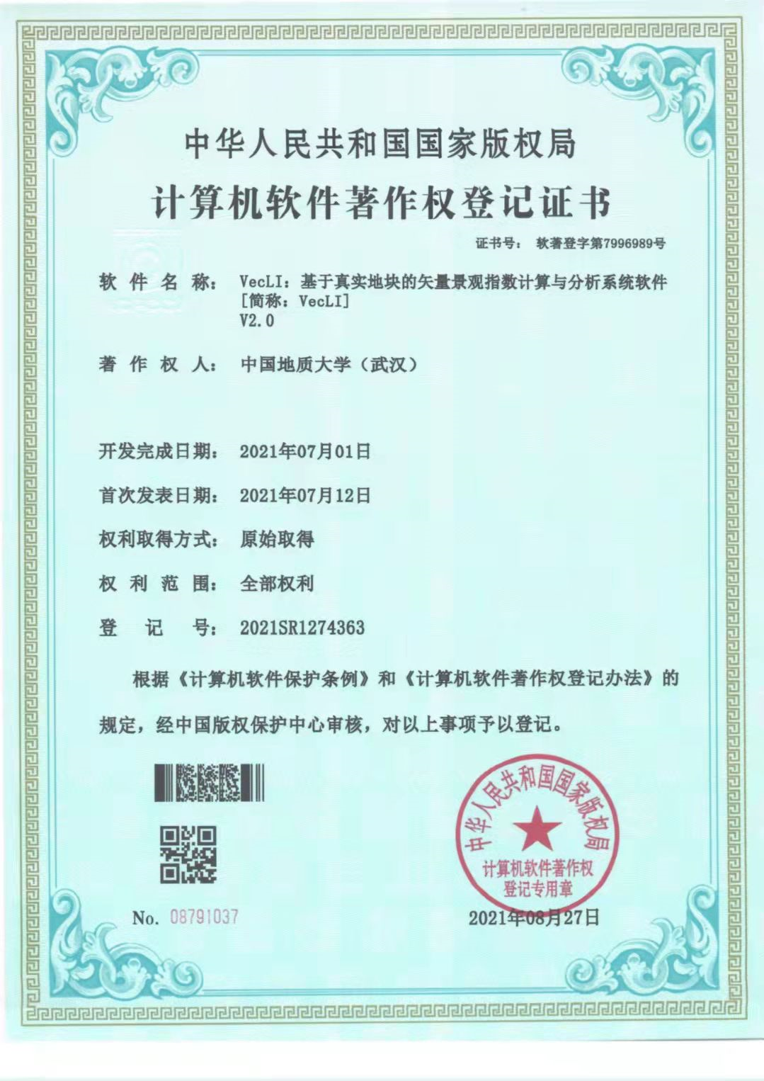
软件著作权 | VecLI:基于真实地块的矢量景观指数计算与分析系统软件[简称:VecLI] V2.0
VecLI:基于真是地块的矢量景观指数计算与分析系统软件[简称:VecLI] V.20登记号:2021SR1274363